 Metadata Catalogue
Topography
Type of resources
Available actions
Topics
Keywords
Contact for the resource
Provided by
Representation types
Update frequencies
status
Scale
Resolution
-
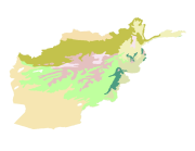
Digital polygon dataset of Ecological Regions of Afghanistan. This dataset is basic vector layer acquired from ESRI Data and Maps 2001.
-

Digital polygon dataset of Ecological Regions of Pakistan. This dataset is basic Vector layer acquired from ESRI Data and Maps, 2001.
-
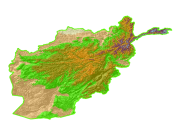
Digital Grid dataset of Elevation Zones of Afghanistan. This dataset is acquired from ESRI Data and Maps 2001 and has been derived from 90 meter SRTM.
-

Digital polygon dataset of Elevation Zones of Hindu Kush Himalayan (HKH) Region. This dataset is derived from USGS, GTOPO30 (global digital elevation model, DEM) with has approximately 1 kilometer spatial resolution.
-
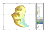
Digital Elevation Model of Gyoko, Nepal is based on Topographic map scale 1:25,000/50,000 acquired from National Geographic Information Infrastructure Project (NGIIP), Dept. of Survey Kathmandu Nepal.
-
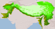
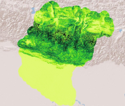
Digital raster dataset of Mountain regions of Hindu Kush Himalayan (HKH) Region. This dataset is prepared based on GTOPO 1km resolution DEM showing different classes of mountains in HKH region.
-
Digital line data of Contours of RDT Centre of Bhutan. Contour interval is 1 meter and the dataset is prepared by ICIMOD based on ground survey 2008.
-

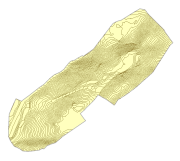
Digital point dataset of spot height (elevation) locations of Central Karakoram National Park (CKNP) area, Pakistan. This dataset is created using topographic sheet maps at scale of 20000.
-
Digital point data of Spot height of RDT Centre of Bhutan. This dataset is prepared by ICIMOD based on ground survey 2008.
-
Digital grid dataset of Slope of Koshi Basin. This dataset is created using SRTM DEM 90 meter spatial resolution data.