 Metadata Catalogue
Keyword
Sub Basin Boundary
Type of resources
Available actions
Topics
Keywords
Contact for the resource
Provided by
Representation types
Update frequencies
status
Resolution
From
1
-
1
/
1
-
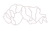
Digital polygon dataset of Sub Watershed boundaries of Bhutan. This dataset is extracted using the SRTM DEM. The boundaries were refined using LandSat images of 30m resolution. The watershed boundaries were further divided into sub-watershed boundaries in the glaciated region.