 Metadata Catalogue
Structure
Type of resources
Available actions
Topics
Keywords
Contact for the resource
Provided by
Years
Representation types
Update frequencies
status
Scale
Resolution
-
Digital line dataset of Geological fault lines of Afghanistan. This dataset is acquired from USGS.
-

Digital point dataset of Hotels of Central Karakoram National Park(CKNP) area, Pakistan. This dataset is compiled through GPS based field survey conducted in year 2008.
-

Digital point data of Bank locations in Central Karakoram National Park (CKNP) area, Pakistan. The dataset is compiled through GPS based field survey conducted in year 2008.
-
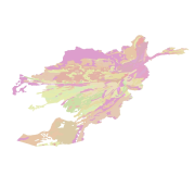
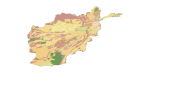
Digital polygon dataset of Geology of Afghanistan. This dataset is basic vector layer acquired from ESRI Data and Maps 2001.
-
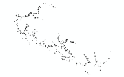
Digital point dataset of Settlements of Central Karakoram National Park(CKNP) area, Pakistan. This dataset is created from topographic sheet maps at scale of 20000 and GPS based field survey conducted in year 2008.
-

Digital point dataset of Post Office locations of Central Karakoram National Park (CKNP) area, Pakistan. This dataset is compiled through GPS based field survey conducted in year 2008.
-

Digital point dataset of Playground Location in Central Karakoram National Park(CKNP) area, Pakistan. This dataset is compiled through GPS based field survey conducted in year 2008.
-
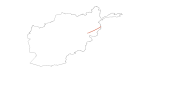
Digital polygon dataset of Geological Joints of Afghanistan . This dataset is basic vector layer acquired from USGS.
-

Digital point dataset of Helipad in Central Karakoram National Park(CKNP) area, Pakistan. This dataset is compiled through GPS based field survey conducted in year 2008.
-

Digital point dataset of Bridge locations of Central Karakoram National Park (CKNP) area, Pakistan. This dataset is created using topographic sheet maps at scale of 20000.