 Metadata Catalogue
School
Type of resources
Topics
Keywords
Contact for the resource
Provided by
Years
Representation types
Update frequencies
status
Scale
-

Digital polygon dataset of Type of Schools per District of Afghanistan. This dataset is basic Vector layer derived from Afghanistan Information Management Systems (AIMS), Afghanistan.
-
Digital polygon dataset of Total number of Students per District of Afghanistan. This dataset is basic Vector layer derived from Afghanistan Information Management Systems (AIMS), Afghanistan.
-
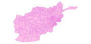
This dataset is created using 1:1,000,000 scale map of Afghanistan and derived from Afghanistan Information Management Systems (AIMS), Afghanistan and ESRI Data and Maps 2001.
-
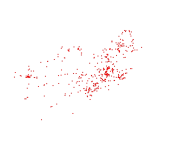
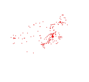
Digital point dataset of Location of Education institutions of Afghanistan. This dataset is acquired from ESRI Map & Data 2001 and Afghanistan Information Management Systems (AIMS), Afghanistan.
-

Digital polygon dataset of Total number of Students per District of Afghanistan. This dataset is basic Vector layer derived from Afghanistan Information Management Systems (AIMS), Afghanistan.
-
Digital point dataset of Location of Primary Schools of Afghanistan. This dataset is derived from Afghanistan Information Management Systems (AIMS), Afghanistan.
-
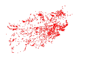
Digital polygon dataset of Location of Education institutions per District of Afghanistan. This dataset is basic Vector layer acquired from ESRI Data and Maps, 2001 and derived from Afghanistan Information Management Systems (AIMS), Afghanistan.
-
Digital polygon dataset of Students Teacher Ration per District of Afghanistan. This dataset is basic Vector layer derived from Afghanistan Information Management Systems (AIMS), Afghanistan.
-

Digital point data of Education institutions location of Sagarmatha National Park, Nepal. This dataset is created using Topographic sheet data at scale of 25,000/50,000, of 1995 acquired from National Geographic Information Infrastructure Project (NGIIP), Dept. of Survey, Nepal and Tourist maps published by various map publishing companies.