 Metadata Catalogue
Sagarmatha National Park
Type of resources
Topics
Keywords
Contact for the resource
Provided by
Representation types
Update frequencies
status
Scale
-

Digital point data of Education institutions location of Sagarmatha National Park, Nepal. This dataset is created using Topographic sheet data at scale of 25,000/50,000, of 1995 acquired from National Geographic Information Infrastructure Project (NGIIP), Dept. of Survey, Nepal and Tourist maps published by various map publishing companies.
-
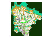
Digital dataset of Land cover of 2000 Sagarmatha National Park, Nepal. This dataset is created using LandSat ETM+ satellite image of 2000 October 30.
-

Digital point data of Settlements Location of Sagarmatha National Park, Nepal. This dataset is created using Topographic sheet data at scale of 25,000/50,000, of 1995 acquired from National Geographic Information Infrastructure Project (NGIIP), Dept. of Survey, Nepal.
-

Digital point data of Campsite Location of Sagarmatha National Park, Nepal. This dataset is created using Topographic sheet data at scale of 25,000/50,000, of 1995 acquired from National Geographic Information Infrastructure Project (NGIIP), Dept. of Survey, Nepal.
-

Digital point data of Airport Location of Sagarmatha National Park, Nepal. This dataset is created using Topographic sheet data at scale of 25,000/50,000, of 1995 acquired from National Geographic Information Infrastructure Project (NGIIP), Dept. of Survey, Nepal and Tourist maps published by various map publishing companies.
-
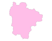
Digital polygon dataset of National Park and Buffer zone Boundary of Sagarmatha National Park, Nepal. This dataset is created using Topographical sheet data at scale of 25,000/50,000, of 1995 acquired from National Geographic Information Infrastructure Project (NGIIP), Department of Survey, Nepal and verified from WWF Nepal.
-
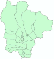
Digital polygon dataset of Ward Boundaries of VDCs of Sagarmatha National Park, Nepal. This dataset is created using Topographic sheet data at scale of 25,000/50,000, of 1995 acquired from National Geographic Information Infrastructure Project (NGIIP), Dept. of Survey, Nepal. and WWF Nepal.
-
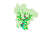
Digital dataset of vegetation change analysis between 1992 and 2000 in Sagarmatha National Park, Nepal. The vegetation change analysis has been done based on satellite image interpretations using Landsat TM for 1992(1992Sep22) and Landsat ETM+ for 2000 (2000_Oct_30).
-

Digital polygon dataset of Glaciers in Sagarmatha National Park, SNP area. This dataset is extracted from inventory of glaciers and glacial lakes prepared by ICIMOD, 2002.
-
Digital polygon dataset of Ecological zones of Sagarmatha National Park, Nepal. This dataset is created using Ecological map of Nepal prepared by Dobremez, 1988. The data was prepared for the HKKH Partnership Project for Systemic Planning and Management of Mountain Ecosystems.