 Metadata Catalogue
Keyword
Road
Type of resources
Available actions
Topics
Keywords
Contact for the resource
Provided by
Representation types
Update frequencies
status
Scale
From
1
-
3
/
3
-
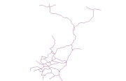
Road (line) vector digital data build based on Gorkha District Map of Suspension Bridge Division (SBD, 1:125,000), 1989.
-
The layer shows the roads in class 1 class 2 and class 3 all over the country
-
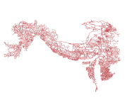
Digital line data of Road Network of Hindu Kush Himalayan (HKH) Region. This dataset is basic vector layer derived from ESRI Map & Data in 2001.