 Metadata Catalogue
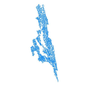
Rangamati
Type of resources
Topics
Keywords
Contact for the resource
Provided by
Representation types
Update frequencies
status
Scale
-
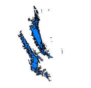
Digital polygon dataset of Water bodies of Rangamati of Bangladesh. This dataset is basic vector layer based on LGED Administrative Base Map of Bangladesh.
-
492_s.png)
Digital polygon dataset of River Network of Rangamati of Bangladesh. This dataset is basic vector layer based on LGED Administrative Base Map of Bangladesh.
-
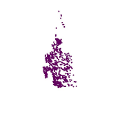
Digital point dataset of Location of Infrastructures of Rangamati of Bangladesh. This dataset is basic vector layer based on LGED Administrative Base Map of Bangladesh.
-
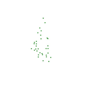
Digital point dataset of Location of Growth Centers of Rangamati of Bangladesh. This dataset is basic vector layer based on LGED Administrative Base Map of Bangladesh.
-
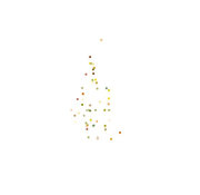
Digital point dataset of Location of Union Head Quarter of Rangamati of Bangladesh. This dataset is basic vector layer prepared based on LGED Administrative Base Map of Bangladesh.
-
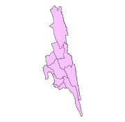
Digital polygon dataset of Sub-District Boundary of Rangamati of Bangladesh. This dataset is basic vector layer based on LGED Administrative Base Map of Bangladesh.
-
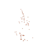
Digital point dataset of Location of Market centers (Haat bazaars) of Rangamati of Bangladesh. This dataset is basic vector layer based on LGED Administrative Base Map of Bangladesh.
-

Digital line dataset of Road Network of Rangamati of Bangladesh. This dataset is basic vector layer based on LGED Administrative Base Map of Bangladesh.
-
Digital line dataset of River Network of Rangamati of Bangladesh. This dataset is basic vector layer based on LGED Administrative Base Map of Bangladesh.