 Metadata Catalogue
Phobjikha
Type of resources
Topics
Keywords
Contact for the resource
Provided by
Representation types
Update frequencies
status
Scale
-
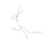
Digital line dataset of Road Network of Phobjikha Valley, Bhutan. This dataset is created using topographic sheet maps at scale of 50000 and prepared by ICIMOD.
-
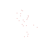
Digital point dataset of Settlements of Phobjikha valley, Bhutan. This dataset is created using topographic sheet maps at scale of 50000 and prepared by ICIMOD.
-
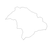
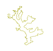
Digital line dataset of Watershed Boundary of Phobjikha Valley, Bhutan. This dataset is created using topographic sheet maps at scale of 50000 and prepared by ICIMOD.
-
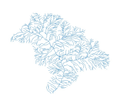
Digital line dataset of River Network of Phobjikha Valley, Bhutan. This dataset is created using topographic sheet maps at scale of 50000 and prepared by ICIMOD.
-
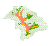
Digital polygon dataset of Management Zones of Phobjikha Valley, Bhutan. This dataset is created using topographic sheet maps at scale of 50000 and prepared by ICIMOD.
-
Digital polygon dataset of Black Neck Crane Habitat locations of Phobjikha Valley, Bhutan. This dataset is based on topographic sheet maps at scale of 50000 and prepared by ICIMOD.
-
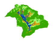
Digital dataset of Land Cover of Phobjikha, Bhutan. This dataset is derived from 2.5m SPOT5 satellite image.