 Metadata Catalogue
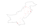
Pakistan
Type of resources
Available actions
Topics
Keywords
Contact for the resource
Provided by
Representation types
Update frequencies
status
Scale
Resolution
-

Digital polygon data of Floodplains of Central Karakoram National Park(CKNP) area, Pakistan. This dataset is compiled using water indices from satellite imagery
-
Digital grid dataset of Populated places of Pakistan. This dataset is Basic grid layer derived from ESRI Map & Data 2001.
-
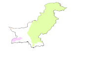
Digital polygon dataset of Major River Basins of Pakistan. This dataset is Basic Vector layer derived from ESRI Map & Data 2001.
-

Digital point dataset of Camping sites locations of Central Karakoram National Park(CKNP) area, Pakistan. This dataset is compiled through GPS based field survey conducted in year 2008.
-
Digital polygon dataset of Country Boundary of Pakistan. This dataset is basic Vector layer acquired from ESRI Data and Maps, 2001.
-

Digital point dataset of Gemstone Mine locations of Central Karakoram National Park(CKNP) area, Pakistan. This dataset is compiled through GPS based field survey conducted in year 2008.
-
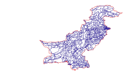
Digital line dataset of Road Network of Pakistan. This dataset is Basic Vector layer derived from ESRI Map & Data 2001.
-
Digital polygon dataset of Annual Mean Minimum Temperature for Pakistan. The dataset is derived from Digital Chart of the world, DCW. The data layer is generated through interpolation of average monthly mimimum temperature data from weather stations on a 30 arc-second resolution grid.
-
Digital line dataset of RailRoad Network of Pakistan. This dataset is Basic Vector layer derived from ESRI Map & Data 2001.
-

Digital point dataset of Hotels of Central Karakoram National Park(CKNP) area, Pakistan. This dataset is compiled through GPS based field survey conducted in year 2008.