 Metadata Catalogue
Outline
Type of resources
Available actions
Topics
Keywords
Contact for the resource
Provided by
Years
Formats
Representation types
Update frequencies
status
Scale
-
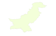
Digital polygon dataset of Country Boundary of Pakistan. This dataset is basic Vector layer acquired from ESRI Data and Maps, 2001.
-

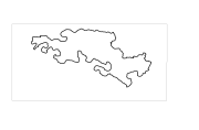
Digital line dataset of outline boundary of Hindu Kush Himalayan (HKH) Region. This dataset is Basic Vector layer derived from ESRI Map & Data 2001 and is in 1:1 million scale.
-
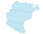
Digital polygon dataset of Park Boundary of Central Karakoram National Park (CKNP) area, Pakistan. This dataset is created using topographic sheet maps at scale of 20000.
-
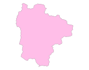
Digital polygon dataset of Administrative boundary of Qomolangma Natural Preserve (QNP), Tibet, China.
-
Digital polygon dataset of National Park and Buffer zone Boundary of Sagarmatha National Park, Nepal. This dataset is created using Topographical sheet data at scale of 25,000/50,000, of 1995 acquired from National Geographic Information Infrastructure Project (NGIIP), Department of Survey, Nepal and verified from WWF Nepal.
-
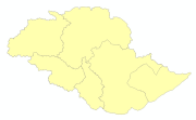
Digital polygon dataset of District boundary of Central Karakoram National Park(CKNP) area, Pakistan. This dataset is created using topographic sheet maps at scale of 20000.
-
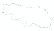
Digital polygon dataset of International boundaries of countries of Koshi Basin. This dataset is derived from HKH Country boundary database.