 Metadata Catalogue
Nepal
Type of resources
Available actions
Topics
Keywords
Contact for the resource
Provided by
Years
Formats
Representation types
Update frequencies
status
Scale
Resolution
-

Landslide data of Koshi basin is digitized from topo sheets published in 1990s.
-
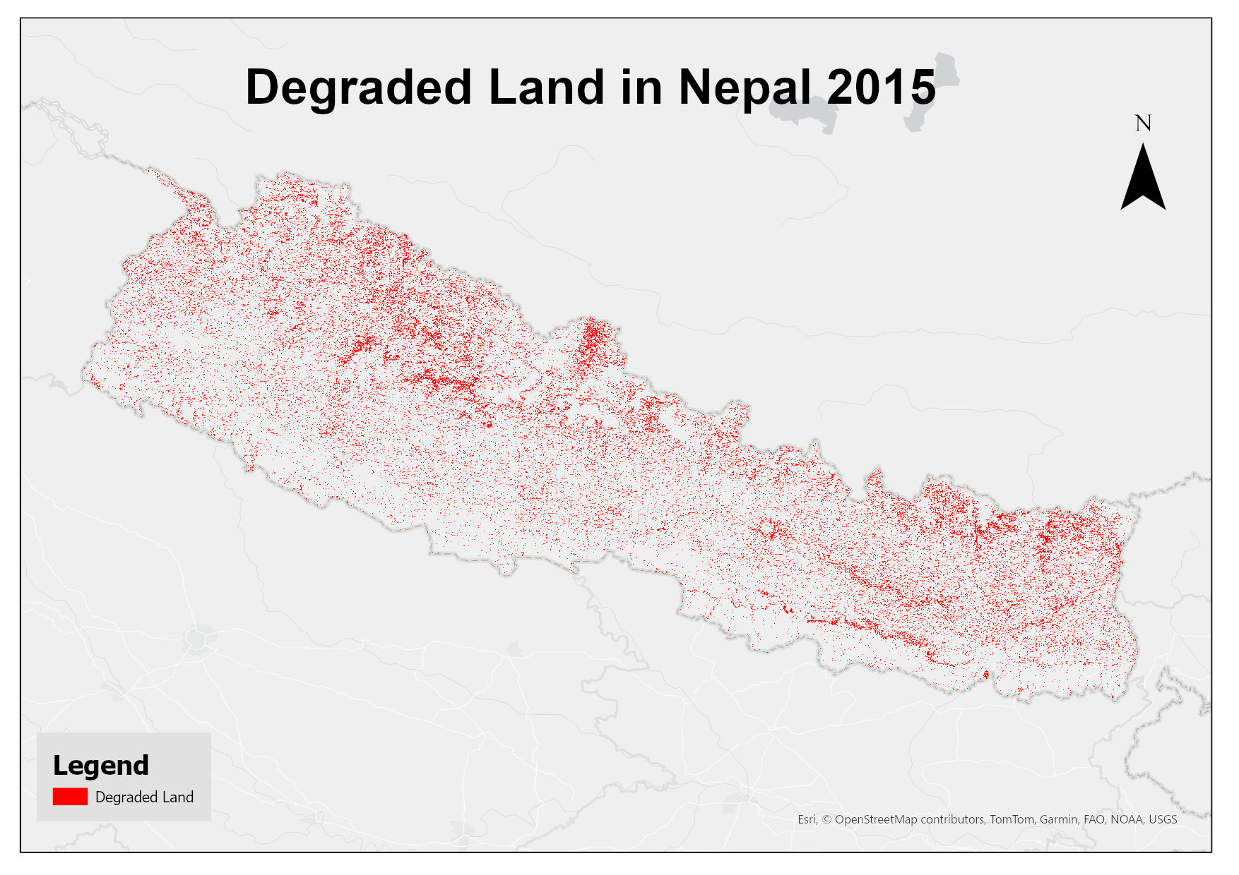
This dataset assesses land degradation in Nepal in 2015 based on SDG Indicator 15.3.1 by analyzing changes in land cover, land productivity, and soil organic carbon stocks. The 1OAO principle is applied in the computation method where changes in the sub-indicators are classified as improving, declining and stable. A land unit is considered degraded if any sub-indicator shows a negative or remains stable when previously degraded.
-
Eddy Covariance Station measuring turbulent fluxes on Lirung Glacier over approximately 16 days in October 2016.
-
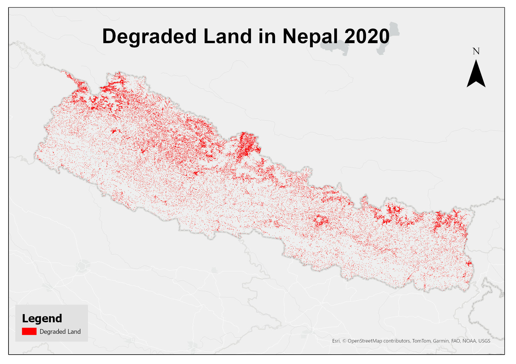
This dataset assesses land degradation in Nepal in 2020 based on SDG Indicator 15.3.1 by analyzing changes in land cover, land productivity, and soil organic carbon stocks. The 1OAO principle is applied in the computation method where changes in the sub-indicators are classified as improving, declining and stable. A land unit is considered degraded if any sub-indicator shows a negative or remains stable when previously degraded.
-

Landslide data of Koshi basin was digitized from Landsat and Googel Earth.
-

Landslide data of Koshi basin was digitized from toposheet maps published in 1960s.
-
Digital polygon data of Land Capability of Western Nepal. The dataset includes details of land forms, slopes, soil type, drainage conditions etc. This dataset is created using Land use Map, published by Land Resource Mapping Project (LRMP), Dept. of Survey Kathmandu, Nepal in 1984.
-
Eddy Covariance Station measuring turbulent fluxes on Yala Glacier to study sublimation of snow and ice. The setup was installed at the main AWS on Yala Glacier.
-
Digital point data of Location of meteorological stations of Nepal. This dataset is based on data from Department of Hydrology & Meteorology, Nepal.
-
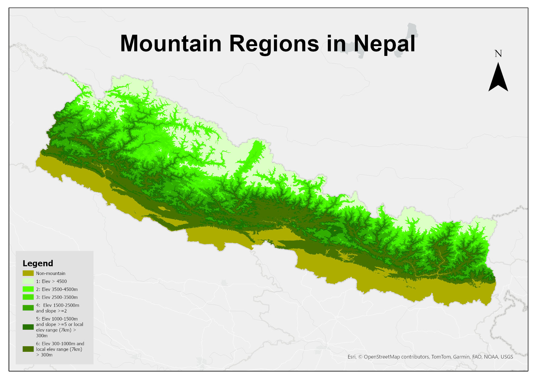
Digital 30m resolution raster dataset of mountain regions in Nepal. This dataset is prepared based on SRTM 30m resolution DEM showing different classes of mountains in the country defined by the Kapos et al. (2000): Class 1: elevation > 4500m; Class 2: elevation 3500–4500m; Class 3: elevation 2500-3500m; Class 4: elevation 1500–2500m and slope >= 2deg; Class 5: elevation 1000–1500m and slope >= 5deg or local elevation range (7km radius) > 300m; Class 6: elevation 300–1000m and local elevation range (7km radius) > 300m;