 Metadata Catalogue
Natural resource
Type of resources
Topics
Keywords
Contact for the resource
Provided by
Representation types
Update frequencies
status
Scale
-
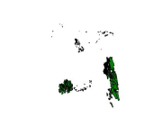
Digital polygon dataset of Forest area of Bangladesh. This dataset is basic vector layer based on LGED Administrative Base Map of Bangladesh.
-
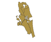
Digital polygon dataset of Forest area of Bandarban of Bangladesh. This dataset is basic vector layer prepared based on LGED Administrative Base Map of Bangladesh.
-

Digital line dataset of Location of Reserve Forest area of Divang Valley, India. This dataset is created using Base map published Survey of India.
-
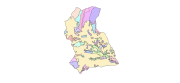
Digital polygon dataset of Community Forest area Boundary of Charnawati Watershed, Dolakha, Nepal. This dataset iscreated using GeoEye 0.5 meter spatial resolution satellite image of November 2009 and field verified in 2010. The data was prepared for the Reducing Emission from Deforestation and Forest Degradation (REDD) Pilot Project. This is a joint project of ICIMOD with Asian Network for Sustainable Agriculture and Bioresources (ANSAB) and Federation of Community for Forest Users of Nepal (FECOFUN) funded by NORAD.