 Metadata Catalogue
MODIS
Type of resources
Available actions
Topics
Keywords
Contact for the resource
Provided by
Representation types
Update frequencies
status
Scale
Resolution
-
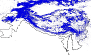
The data contains improved daily MODIS Terra/Aqua combined snow-cover merged with Randolph Glacier Inventory (RGI6.0) product. This product is generated using MODIS Terra and Aqua daily snow cover products MOD10A1 and MYD10A1 collection 6 (C6), respectively. The data covers High Mountain Asia (HMA) covering latitude 24.32− 49.19 N and Longitude 58.22 - 122.48 E with temporal coverage between 2002 and 2019. The data has daily temporal resolution and 500 m spatial resolution. The product is named as M*D10A1GL06 derived from MODIS Terra (MOD) MODIS Aqua (MYD), original product number (10A1) and Glacier (GL), Version 6 (06). The product is described in ordinal date available in GeoTIFF file format as described in the associated Dataset README. For more details about the data, please read the paper associated with this data titled "An improved Terra-Aqua MODIS daily cloud-free snow and Randolph Glacier Inventory 6.0 combined product (M*D10A1GL06) for high-mountain Asia between 2002 and 2019" in Earth System Science Data Journal.
-
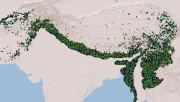
The product contains improved MODIS 8-day Terra (MOD10A2) and Aqua (MYD10A2) collection 6.1 snow-cover composite product. The product is generated using MODIS Terra and Aqua 8-day snow cover products MOD10A2 and MYD10A2 collection 6.1 (C61), respectively. The data covers the Ganges River Basin. The data is available with eight-day temporal resolution and 500 m spatial resolution covering the period between 2002 and 2025. The product is described in ordinal date and each year has 46 eight-day composite images in GeoTIFF file format. The data is described by the values 25, 50, 198, 199, and 200. Following is the description of values in the improved combined snow product 25: No Snow classes 50: Cloud 198: Snow only in Terra 199: Snow only in Aqua 200: Snow in both Terra and Aqua
-
The data contains an enhanced MODIS 8-day Terra (MOD10A2) and Aqua (MYD10A2) collection 6 snow-cover composite product merged with Randolph Glacier Inventory (RGI6.0). The data is specifically developed for the High Mountain Asia (HMA) with the geographic coverage between latitude 24.32 − 49.19 N and Longitude 58.22 − 122.48 E. The data is available with eight-day temporal resolution and 500 m spatial resolution covering the period between 2002 and 2018. The name of the product is derived from MODIS Terra (MOD) MODIS Aqua (MYD), and Glacier (GL), Version 6 (06) as MOYDGL06*. The product is described in Julian day and each year has 46 eight-day composite images in GeoTIFF file format as described in the associated readme.TXT. The data can be accessed alternatively from https://doi.org/10.1594/PANGAEA.901821. The R code developed for this product is available at https://doi.org/10.5281/zenodo.3610735. For more details about the data, please read the paper associated with this data titled lease read the paper associated with this data titled "An improved Terra/Aqua MODIS snow-cover and RGI6.0 glacier combined product (MOYDGL06*) for the High Mountain Asia between 2002 and 2018" published in Earth System Science Data Journal.
-
The product contains improved MODIS 8-day Terra (MOD10A2) and Aqua (MYD10A2) collection 6.1 snow-cover composite product merged with Randolph Glacier Inventory (RGI6.0). The product is generated using MODIS Terra and Aqua 8-day snow cover products MOD10A2 and MYD10A2 collection 6.1 (C61), respectively. The data covers High Mountain Asia (HMA) covering latitude 24.32 − 49.19 N and Longitude 58.22 − 122.48 E. The data is available with eight-day temporal resolution and 500 m spatial resolution covering the period between 2002 and 2022. The name of the product is derived from MODIS Terra (MOD) MODIS Aqua (MYD), and Glacier (GL), Version 6.1 (61) as M*D10A2V61GL. The product is described in ordinal date and each year has 46 eight-day composite images in GeoTIFF file format. The data is described by the values 25, 50, 198, 199, 200, 238, 239, 240, 242, 248, 249, 250, and 252. Following is the description of values in the improved combined snow product 25: No Snow classes 50: Cloud 198: Snow only in Terra 199: Snow only in Aqua 200: Snow in both Terra and Aqua 238: Debris-covered ice with Terra Snow 239: Debris-covered ice with Aqua Snow 240: Exposed debris-covered ice 242: Debris-covered ice with Snow in both Terra and Aqua 248: Debris-free ice with Terra Snow 249: Debris-free ice with Aqua Snow 250: Exposed debris-free ice 252: Debris-free ice with snow in both Terra and Aqua
-

Moderate Resolution Imaging Spectroradiometer (MODIS) based active fire incidents in Bhutan from March 2012 to June 2016. The active fire data has been overlaid with land cover data of Bhutan to find out forest fire incidents in the country.
-

Moderate Resolution Imaging Spectroradiometer (MODIS) based active fire incident location data in Nepal from February 2012 to June 2016. The active fire data has been overlaid with land cover data of Nepal to find out forest fire incidents in the country.
-
Compiled MODIS Active fire dataset of HKH region derived from FIRMS (Fire Information for Resource Management System). The data shows the locations of fire incidents within HKH region on various dates in the period between 2000 to 2010 along with the confidence level information of such incidents.
-
Digital polygon dataset of snow cover area of Hindu Kush Himalayan (HKH) Region. This dataset is generated from 8-day composite 500 m resolution Terra satellite image from MODIS and using global standard MODIS snow product after implementing cloud filtering techniques.