 Metadata Catalogue
Location
Type of resources
Available actions
Topics
Keywords
Contact for the resource
Provided by
Years
Representation types
Update frequencies
status
Scale
Resolution
-
Settlement vector digital data, (selected villages) prepared based on Indian toposheet (1:50,000 enlarged), 1950s.
-
Digital grid dataset of Populated places of Pakistan. This dataset is Basic grid layer derived from ESRI Map & Data 2001.
-
Digital polygon dataset of Security Zones of Afghanistan identified by UN . This dataset is basic vector layer acquired from ESRI Data and Maps 2001.
-
Digital point dataset of Location Protected Areas of Afghanistan. This dataset is created using 1:1,000,000 scale map of Afghanistan and derived from Afghanistan Information Management Systems (AIMS), Afghanistan.
-
This dataset is created using 1:1,000,000 scale map of Afghanistan and derived from Afghanistan Information Management Systems (AIMS), Afghanistan and ESRI Data and Maps 2001.
-
Digital point dataset of Major Cities of Pakistan. This dataset is Basic Vector layer derived from ESRI Map & Data 2001.
-
Digital point dataset of Location of Education institutions of Afghanistan. This dataset is acquired from ESRI Map & Data 2001 and Afghanistan Information Management Systems (AIMS), Afghanistan.
-
Digital point dataset of Location of Primary Schools of Afghanistan. This dataset is derived from Afghanistan Information Management Systems (AIMS), Afghanistan.
-
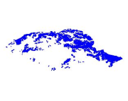
Digital polygon dataset of Snow Cover Area of Pakistan. This dataset is Basic grid layer derived from ESRI Map & Data 2001.
-
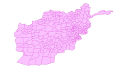
Digital polygon dataset of Location of Education institutions per District of Afghanistan. This dataset is basic Vector layer acquired from ESRI Data and Maps, 2001 and derived from Afghanistan Information Management Systems (AIMS), Afghanistan.