 Metadata Catalogue
Landslide
Type of resources
Available actions
Topics
Keywords
Contact for the resource
Provided by
Years
Representation types
Update frequencies
status
Scale
Resolution
-

Landslide data of Koshi basin was digitized from Landsat and Googel Earth.
-

Landslide data of Koshi basin was digitized from toposheet maps published in 1960s.
-

Landslide data of Koshi basin is digitized from topo sheets published in 1990s.
-
Nepal earthquake of 2015 resulted in activation and re-activation of many landslides in and around epi-center and after shock areas. The landslide inventory was prepared by visually digitizing landslide polygons on Google Earth Pro. The earthquake database contains both pre-event landslide and co-siesmic landslides.
-
Landslide inventory is polygon of every landslide for landslide characterization and analsysis to understand landslide distribution pattern, and identify areas susceptible to landslide events in future. This is important for proper consideration of landuse codes for planning developmental activities.
-
Landslide susceptibility map of Koshi Basin is to identify landslide hazard areas for use during the planning of developmental activities.
-
Landslide susceptibility map of Koshi Basin is to identify landslide hazard areas for use during the plnanning of developmental activities.
-
Landslide susceptibility map of Koshi Basin is to identify landslide hazard areas for use during the plnanning of developmental activities.
-
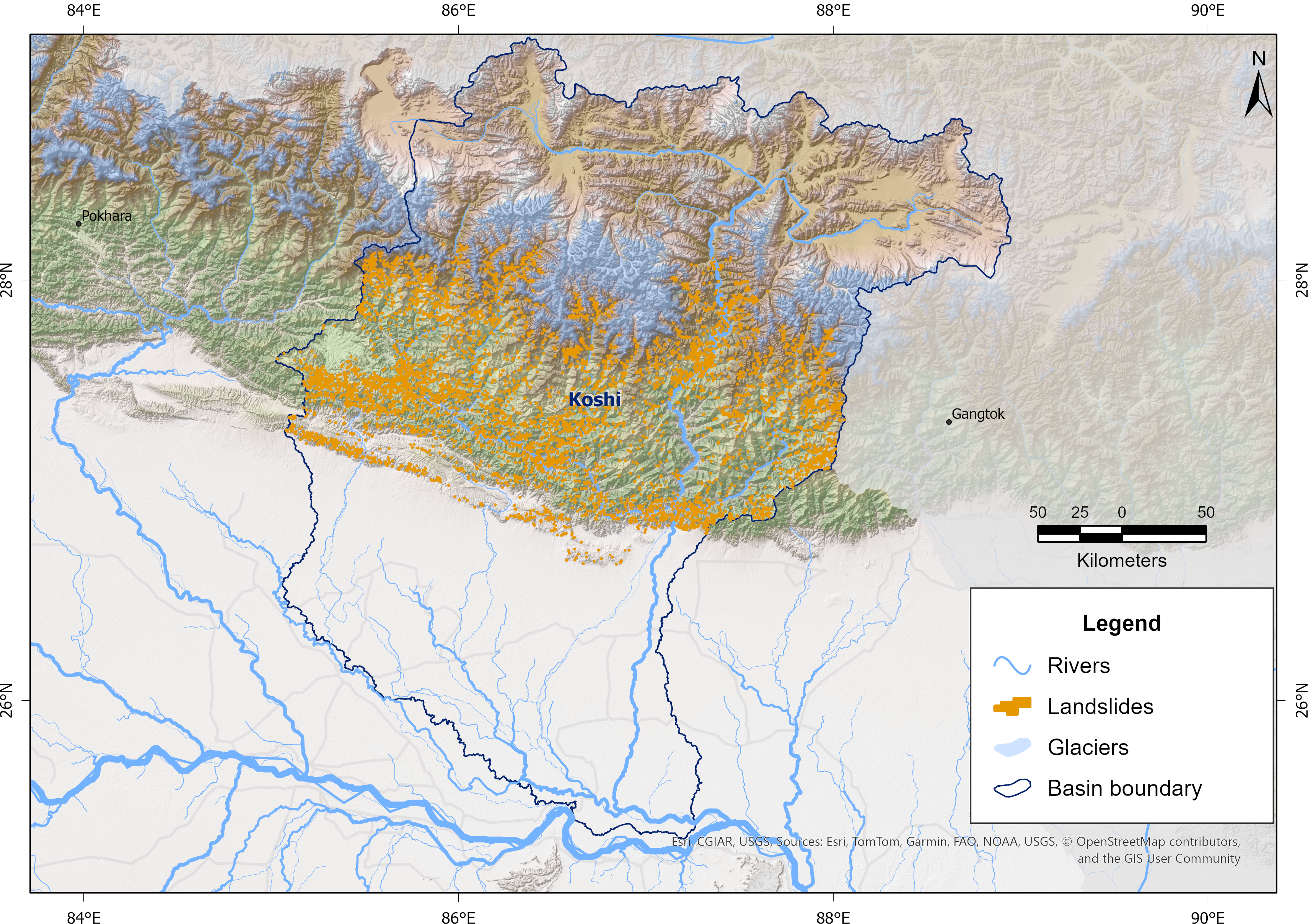
Landslides are a major natural hazard in the Himalayan region, causing significant damage to infrastructure, loss of life, and environmental impacts each year. The Koshi Basin is highly susceptible to landslides due to its steep terrain, intense monsoonal rainfall, active tectonics, and changing land use. To support hazard assessment and disaster risk reduction, a comprehensive landslide inventory of the Koshi Basin was developed using Sentinel-2 imagery and a U-Net-based semantic segmentation approach developed in collaboration with the University of Maryland, Baltimore County, and the NASA Goddard Space Flight Center (GSFC) for NASA’s High Mountain Asia Project. The model was trained using manually delineated multi-temporal landslide datasets from the 2015 Gorkha Earthquake-affected districts of Nepal, produced by NSET-Nepal and Durham University, UK, and accessed through NDRRMA. These automatically detected landslides were refined through manual editing and quality control, and the resulting dataset has been used for continued model improvement and training. The data were prepared as part of the Glacier to Ocean (G2O) Project of ICIMOD in collaboration with the Ocean Policy Research Institute of the Sasakawa Peace Foundation.