 Metadata Catalogue
Land use
Type of resources
Available actions
Topics
Keywords
Contact for the resource
Provided by
Representation types
Update frequencies
status
Scale
Resolution
-
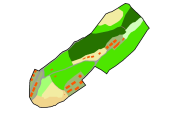
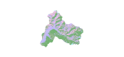
Digital polygon dataset of Land capability of Lamjung district, Nepal. The dataset includes details of potential land uses, soil type, drainage conditions etc. This dataset is created using 1:50,000 scale Land capability map published by Land Resource Mapping Project (LRMP), Department of Survey, Nepal 1984.
-

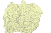
Digital data of Land use of Nepal. This dataset is created using Land use Maps of 50000 scale published by Land Resource Mapping Project (LRMP), Dept. of Survey Kathmandu, Nepal in 1984.
-
Digital data of Land use of RDT Centre of Bhutan. This dataset is prepared by ICIMOD based on ground survey 2008.
-
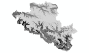
Digital dataset of Land Cover change between 1990 and 2000 of Central Karakoram National Park (CKNP) area, Pakistan. This dataset is derived from the LandSat satellite imagery of 1990 and 2000 to show the change in land cover classes.
-
Digital dataset of Agriculture Cover of Central Karakoram National Park(CKNP) area, Pakistan. This dataset is extracted from land cover dataset of 2010 created from 30m resolution LandSat imagery of 2010.
-
Digital dataset of Land cover of Kayar Khola Watershed, Chitwan, Nepal. This dataset is created using GeoEye 0.5 meter spatial resolution satellite image of November 2009 and field verified in 2010. The data was prepared for the Reducing Emission from Deforestation and Forest Degradation (REDD) Pilot Project. This is a joint project of ICIMOD with Asian Network for Sustainable Agriculture and Bioresources (ANSAB) and Federation of Community for Forest Users of Nepal (FECOFUN) funded by NORAD.
-
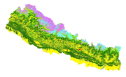
Land cover and its change analysis across the Hindu Kush Himalayan (HKH) region is realized as an urgent need to support diverse issues of environmental conservation. This study presents the first and most complete national land cover database of Nepal prepared using public domain Landsat TM data of 2000 and replicable methodology. The study estimated that 41.64% of Nepal is covered by forests and 27.77% by agriculture. Physiographic regions wise forest fragmentation analysis revealed specific conservation requirements for productive hill and mid mountain regions. Comparative analysis with Landsat TM based global land cover product showed difference of the order of 30-60% among different land cover classes stressing the need for significant improvements for national level adoption. The online web based land cover validation tool is developed for continual improvement of land cover product. The potential use of the data set for national and regional level sustainable land use planning strategies and meeting several global commitments also highlighted.
-
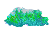
Land cover data of Bhutan for 2010. This dataset is created using the LandSat 30 meter spatial resolution satellite image of 2010.
-

Land cover data of Bhutan for 1990. This dataset is created using the LandSat 30 meter spatial resolution satellite image of 1990.
-
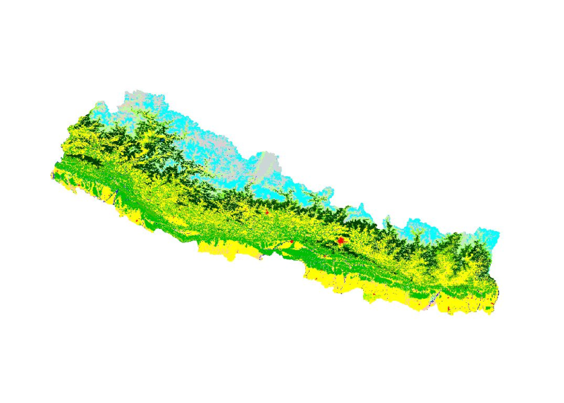
Land cover and its change analysis across the Hindu Kush Himalayan (HKH) region is realized as an urgent need to support diverse issues of environmental conservation. This study presents the first and most complete national land cover database of Nepal prepared using public domain Landsat TM data of 2010 and replicable methodology. The study estimated that 41.9% of Nepal is covered by forests and 27.32% by agriculture. Comparative analysis with Landsat TM based global land cover product showed difference of the order of 30-60% among different land cover classes stressing the need for significant improvements for national level adoption. The online web based land cover validation tool is developed for continual improvement of land cover product. The potential use of the data set for national and regional level sustainable land use planning strategies and meeting several global commitments also highlighted.