 Metadata Catalogue
Lalitpur, Kathmandu, Nepal
Type of resources
Keywords
Contact for the resource
Provided by
Representation types
Update frequencies
status
Scale
-
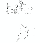
Trees(point) dataset of Lalitpur Municipality for the Geo-visualization on emergency response in case of earthquake disaster.
-
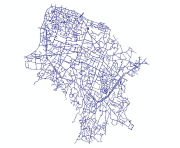
Road edge(polyline) dataset of Lalitpur Municipality for the Geo-visualization on emergency response in case of earthquake disaster.
-

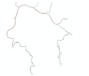
Stream(polyline) dataset of Lalitpur Municipality for the Geo-visualization on emergency response in case of earthquake disaster.
-
Rivers(polygon) dataset of Lalitpur Municipality for the Geo-visualization on emergency response in case of earthquake disaster.
-
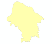
Boundary(polygon) dataset of Lalitpur Municipality for the Geo-visualization on emergency response in case of earthquake disaster.
-

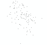
Place Name(point) dataset of Lalitpur Municipality for the geovisualization on emergency response in case of earthquake disaster.
-
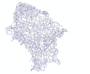
Road edge(polyline) dataset of Lalitpur Municipality for the Geo-visualization on emergency response in case of earthquake disaster.
-
Telephone companies(point) dataset of Lalitpur Municipality for the Geo-visualization on emergency response in case of earthquake disaster.
-

Ponds(polygon) dataset of Lalitpur Municipality for the Geo-visualization on emergency response in case of earthquake disaster.
-
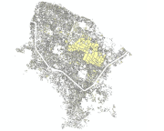
Built-up area (polygon) dataset of Lalitpur Municipality for the Geo-visualization on emergency response in case of earthquake disaster.