 Metadata Catalogue
Inland waters
Type of resources
Available actions
Topics
Keywords
Contact for the resource
Provided by
Years
Representation types
Update frequencies
status
Scale
Resolution
-
This river (line) vector digital data of Gorkha District was prepared by ICIMOD based on Indian toposheet (1:50,000),1950s.
-

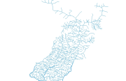
River Systems Vector digital data prepared based on map of Gorkha District (1:125,000), published by Suspension Bridge Division (SBD) 1989.
-
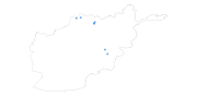
Digital point dataset of Water Resource Features (springs, well and Dams) of Afghanistan. This dataset is basic vector layer acquired from USGS.
-
Topographic Basic Vector Digital Data of the HKHR acquired from ESRI Map & Data 2001.
-
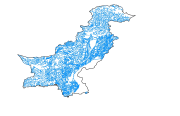
Digital line dataset of River Network of Pakistan. This dataset is Basic Vector layer derived from ESRI Map & Data 2001.
-
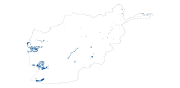
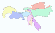
Digital polygon dataset of Lakes of Afghanistan. This dataset is created using 1:1,000,000 scale map of Afghanistan and derived from Afghanistan Information Management Systems (AIMS), Afghanistan.
-

Digital polygon dataset of Water Body (Lakes) of Afghanistan. This dataset is basic Vector layer acquired from ESRI Data and Maps 2001.
-
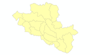
Digital polygon dataset of Watershed of Central Karakoram National Park(CKNP) area, Pakistan. This dataset is derived from 30 meter spatial resolution ASTER DEM.
-
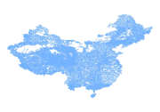
Digital line dataset of River system of China. This dataset is basic vector layer acquired from USGS.
-
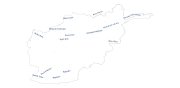
Annotation of River names of of Afghanistan. This dataset is basic Vector layer derived from Afghanistan Information Management Systems (AIMS), Afghanistan.