 Metadata Catalogue
Hindu Kush Himalayan Region
Type of resources
Available actions
Topics
Keywords
Contact for the resource
Provided by
Formats
Representation types
Update frequencies
status
Scale
Resolution
-
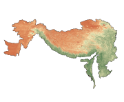
Digital grid data of NDVI of September of Hindu Kush Himalayan (HKH) Region. This dataset is basic vector layer derived from ESRI Map & Data in 2001.
-
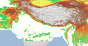
Digital Elevation Model (DEM) of Hindu Kush Himalayan (HKH) Region. This dataset is compiled from global SRTM DEM of 90 m resolution for HKH region and was prepared by ICIMOD.
-
Digital polygon dataset of Major spoken Languages of Hindu Kush Himalayan (HKH) Region. This dataset is basic vector layer derived from ESRI Map & Data in 2001 and language data acquired from CEGG/ICIMOD.
-
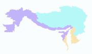
Digital polygon dataset of Geographic regions of Hindu Kush Himalayan (HKH) Region. This dataset is basic vector layer derived from ESRI Map & Data in 2001.
-
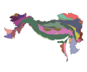
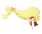
Digital polygon dataset of Geologic Province of Hindu Kush Himalayan (HKH) Region. This dataset is basic Vector layer acquired from USGS.
-
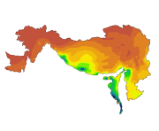
Digital grid data of Mean Precipitation of August for Hindu Kush Himalayan (HKH) Region. This dataset is acquired from USGS.
-
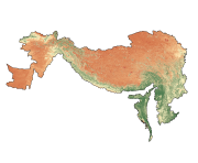
Digital grid data of NDVI of April of Hindu Kush Himalayan (HKH) Region. This dataset is basic vector layer derived from ESRI Map & Data in 2001.
-
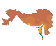
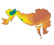
Digital grid data of Mean Precipitation of June for Hindu Kush Himalayan (HKH) Region. This dataset is acquired from USGS.
-
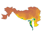
Digital grid data of Mean Precipitation of September for Hindu Kush Himalayan (HKH) Region. This dataset is acquired from USGS.
-
Digital grid data of Mean Precipitation of February for Hindu Kush Himalayan (HKH) Region. This dataset is acquired from USGS.