 Metadata Catalogue
High Mountain Asia
Type of resources
Topics
Keywords
Contact for the resource
Provided by
Representation types
Update frequencies
status
-
High Mountain Asia (HMA) host one of the largest concentrations of lakes globally, which together with snow and ice reserves, serve as an essential water resource for the region. Due to the limited human disturbances these high-altitude lakes serve as sensitive indicators of climate change impacts. However, their vast number, remote location, and challenging mountainous terrain make in-situ measurements scarce. Satellite altimetry offers a unique opportunity to continuously monitor lake water level variation across HMA. Here we present a water level timeseries for 238 lakes (≥ 20 km2) across HMA derived from CryoSat-2 (2010-2023) and ICESat-2 (2018-2024). Water level timeseries from the two independent altimetry missions shows strong consistency with 80% of lakes exhibiting statistically significant agreement in their signals (p = 0.013). The dataset is structured as a single netCDF file with a two-dimensional matrix format, including water level measurements, associated uncertainties, mission identifiers, ice flags, and static lake attributions (location, area). The water level datasets presented enables long-term trend analysis, changes in lake water storage, response to wet-and-dry climate cycles. The dataset also provides essential variables to study relationships between lake ecosystems and changes in the water resources across HMA.
-
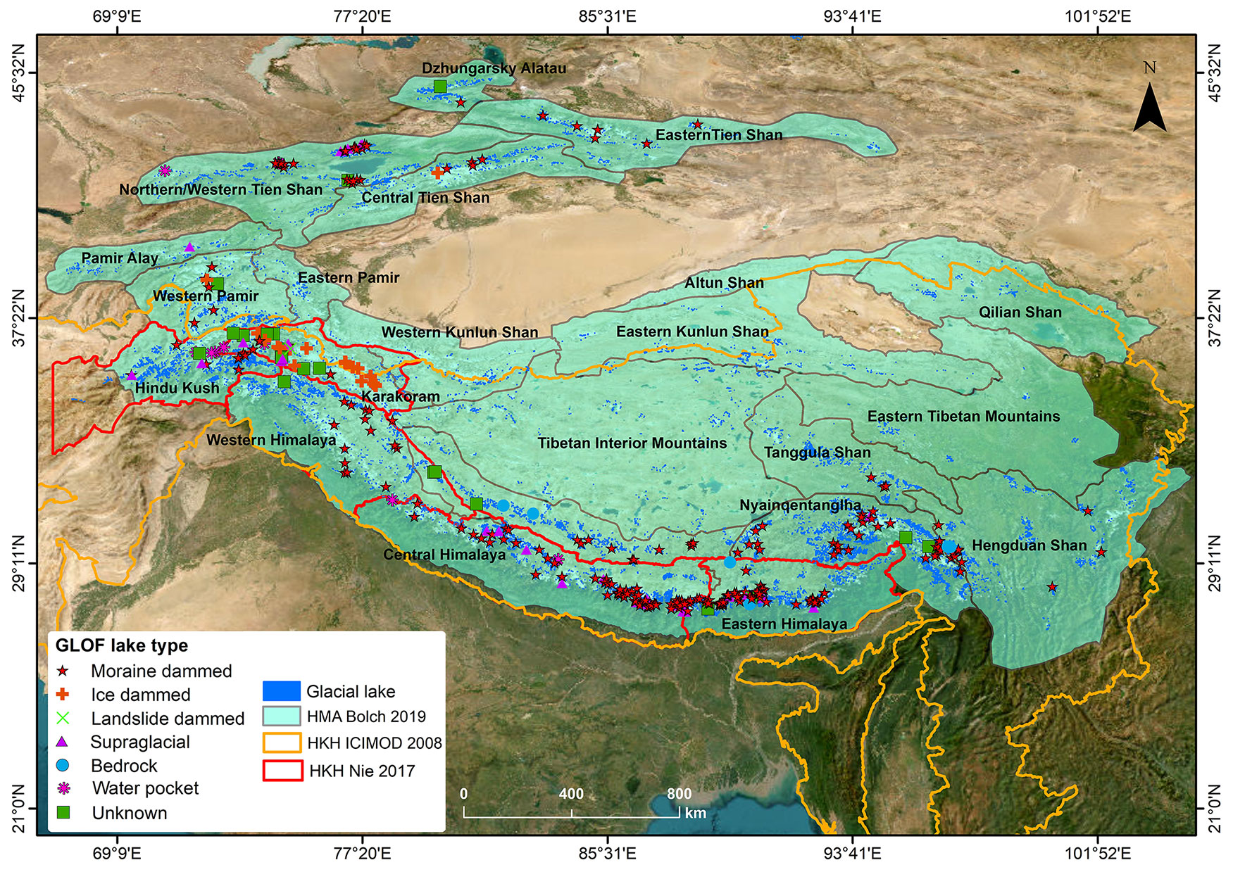
Glacier lake outburst floods (GLOFs) have been intensely investigated in High Mountain Asia (HMA) in recent years and are the most well-known hazard associated with the cryosphere. As glaciers recede and surrounding slopes become increasingly unstable, such events are expected to increase, although current evidence for an increase in events is ambiguous. Many studies have investigated individual events and while several regional inventories exist, they either do not cover all types of GLOF or are geographically constrained. Further, downstream impacts are rarely discussed. Previous inventories have relied on academic sources and have not been combined with existing inventories of glaciers and lakes. In this study, we present the first comprehensive inventory of GLOFs in HMA, including details on the time of their occurrence, processes of lake formation and drainage involved as well as downstream impacts. We document 766 individual GLOFs that occurred between 1533 and 2025. Of these, 23% were recurring events from just three ephemeral ice-dammed lakes. In combination, the documented events resulted in 8996 fatalities of which 906 fatalities were from 24 events, which is three times higher than a previous assessment for the region. The integration of previous inventories of glaciers and lakes within this database will inform future assessments of potential drivers of GLOFs, allowing more robust projections to be developed. The database and future, updated versions, are traceable, version controlled and can be directly incorporated into further analysis. This dataset has been updated in December 2025.