From 1 - 3 / 3
  • Categories  

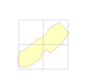
    Digital line data of Graticules (latitude and longitude lines) of Nepal. This dataset is created using Topographic Zonal Map of 250000 scale published by Department of Survey Nepal in 1988 and is in geographic coordinates.

  • Categories  

    Digital line data of Graticules (latitude and longitude lines) of Kathmandu Valley. This dataset is created using Topographic sheet data at scale of 25,000/50,000, of 1996 acquired from National Geographic Information Infrastructure Project (NGIIP), Dept. of Survey, Nepal.

  • Categories  

    Digital line data of Graticules (latitude and longitude) of RDT Centre of Bhutan. This dataset is prepared by ICIMOD based on ground survey 2008.