 Metadata Catalogue
Geoscientific information
Type of resources
Available actions
Topics
Keywords
Contact for the resource
Provided by
Years
Formats
Representation types
Update frequencies
status
Scale
Resolution
-

Landslide data of Koshi basin is digitized from topo sheets published in 1990s.
-
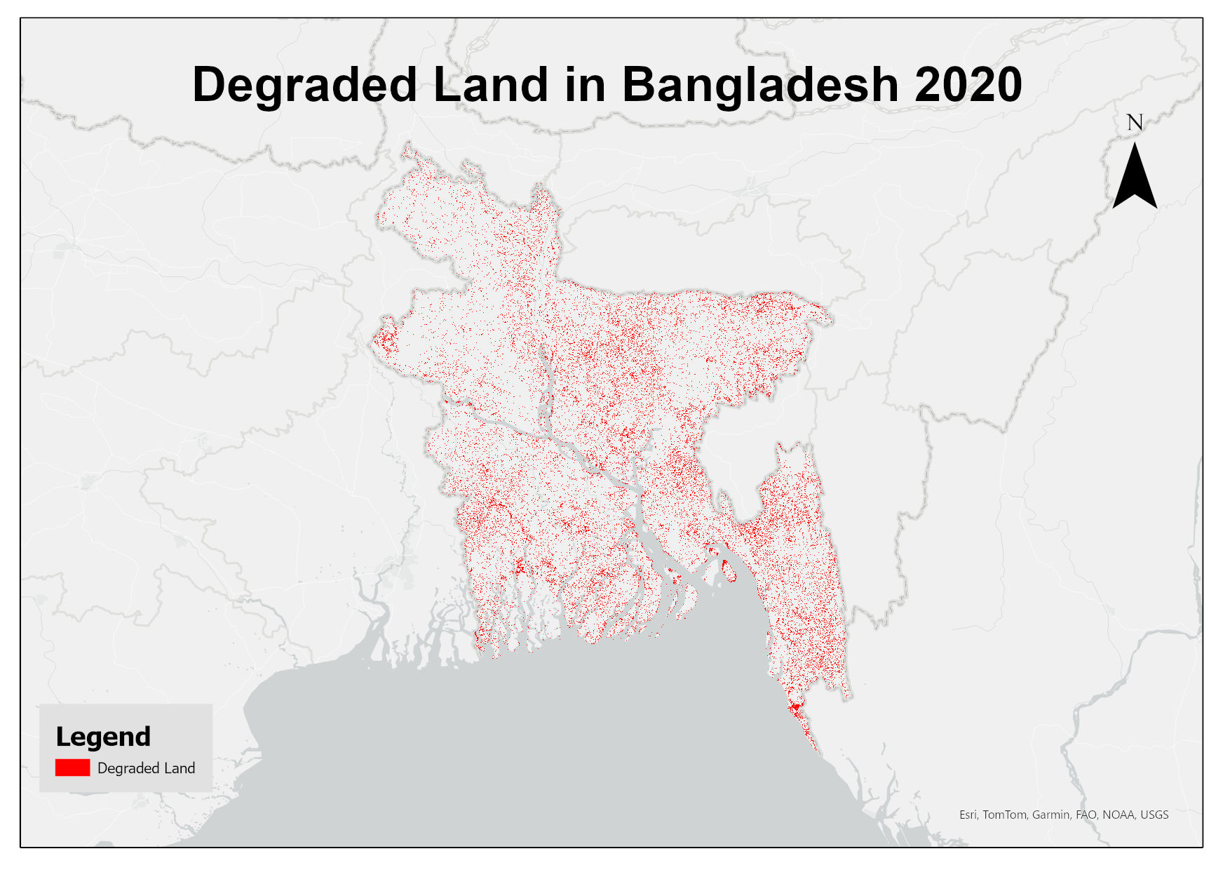
This dataset assesses land degradation in Bangladesh in 2020 based on SDG Indicator 15.3.1 by analyzing changes in land cover, land productivity, and soil organic carbon stocks. The 1OAO principle is applied in the computation method where changes in the sub-indicators are classified as improving, declining and stable. A land unit is considered degraded if any sub-indicator shows a negative or remains stable when previously degraded.
-
The rivers layer shows the shows the location, Length and direction of all rivers across the country.
-
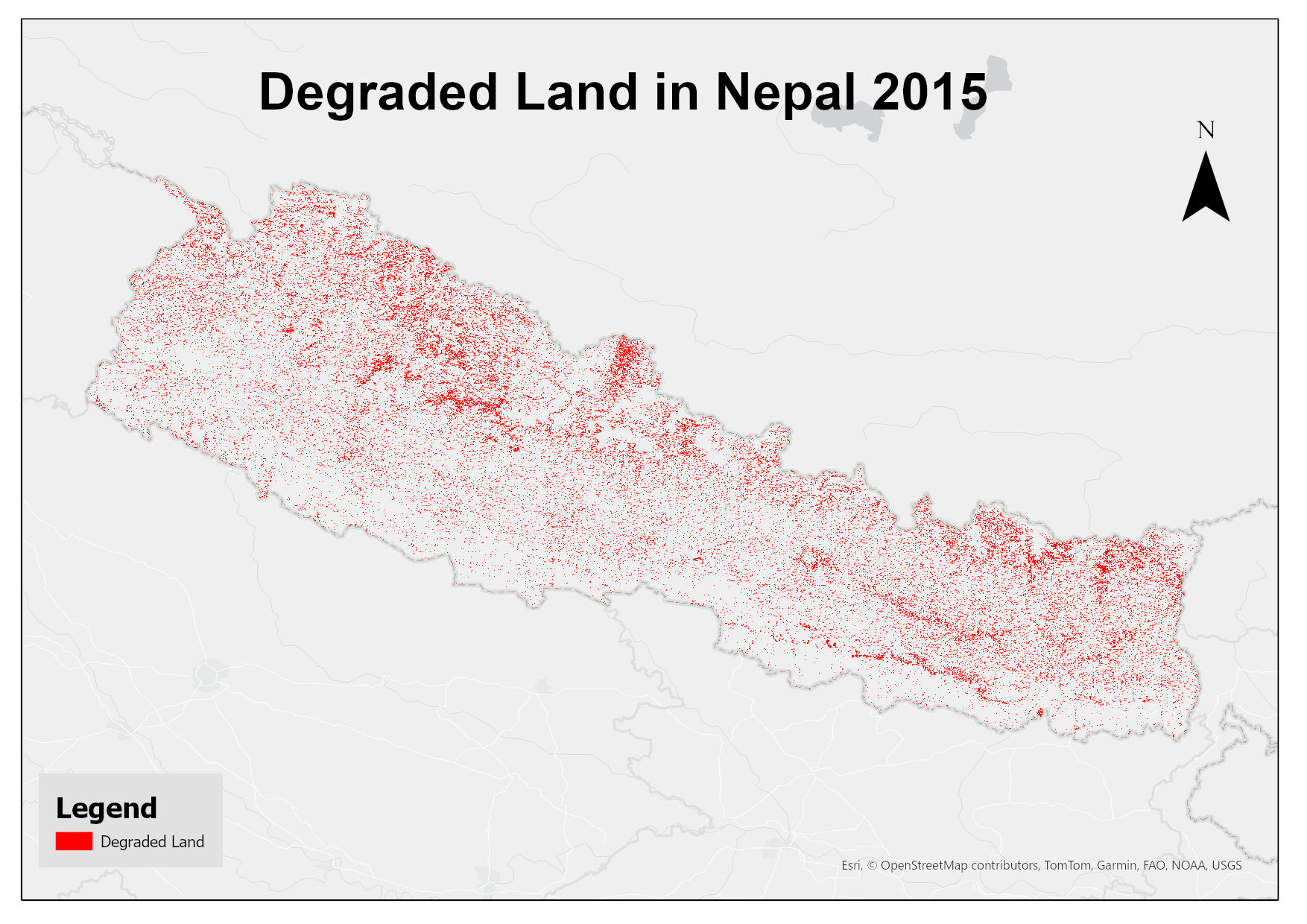
This dataset assesses land degradation in Nepal in 2015 based on SDG Indicator 15.3.1 by analyzing changes in land cover, land productivity, and soil organic carbon stocks. The 1OAO principle is applied in the computation method where changes in the sub-indicators are classified as improving, declining and stable. A land unit is considered degraded if any sub-indicator shows a negative or remains stable when previously degraded.
-
The layer shows the roads in class 1 class 2 and class 3 all over the country
-
Eddy Covariance Station measuring turbulent fluxes on Lirung Glacier over approximately 16 days in October 2016.
-
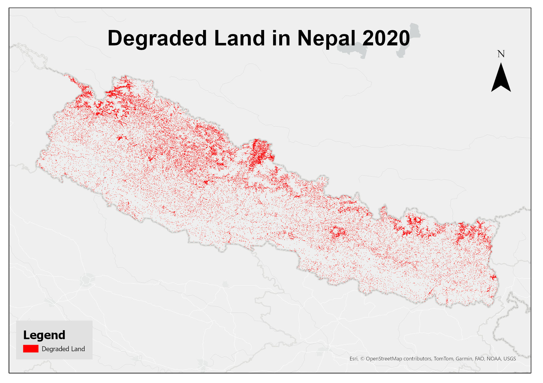
This dataset assesses land degradation in Nepal in 2020 based on SDG Indicator 15.3.1 by analyzing changes in land cover, land productivity, and soil organic carbon stocks. The 1OAO principle is applied in the computation method where changes in the sub-indicators are classified as improving, declining and stable. A land unit is considered degraded if any sub-indicator shows a negative or remains stable when previously degraded.
-
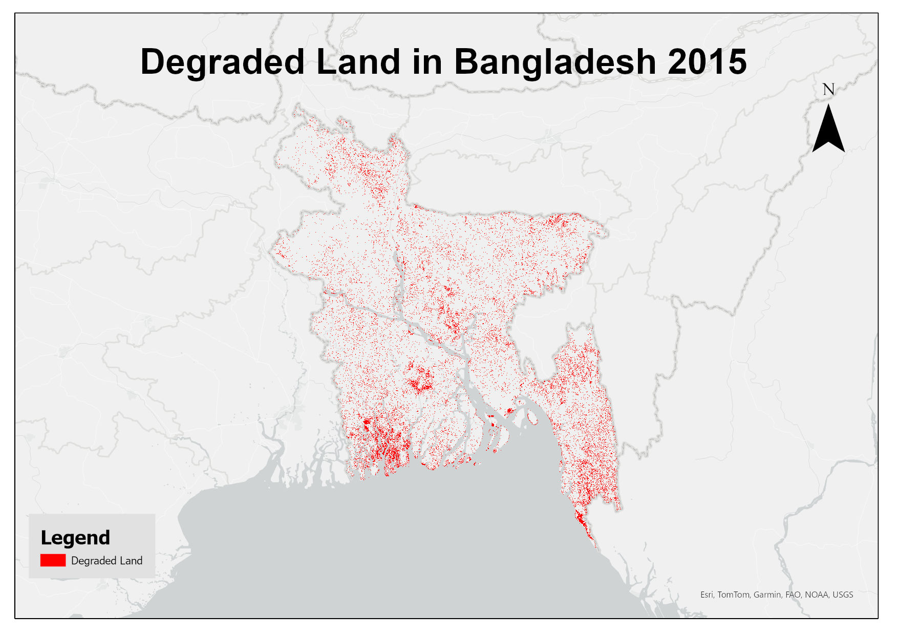
This dataset assesses land degradation in Bangladesh in 2015 based on SDG Indicator 15.3.1 by analyzing changes in land cover, land productivity, and soil organic carbon stocks. The 1OAO principle is applied in the computation method where changes in the sub-indicators are classified as improving, declining and stable. A land unit is considered degraded if any sub-indicator shows a negative or remains stable when previously degraded.
-
This layer gives information about the spatial location of meterological stations established in Kailash Sacred Landscape Area.
-
This layer shows 41 watersheds across the country.