 Metadata Catalogue
Farming
Type of resources
Available actions
Topics
Keywords
Contact for the resource
Provided by
Years
Formats
Representation types
Update frequencies
status
Scale
Resolution
-
Digital polygon dataset of Cultivated land of Afghanistan. This dataset is created using 1:1,000,000 scale map of Afghanistan and derived from Afghanistan Information Management Systems (AIMS), Afghanistan.
-
Digital table data of Livestock population of Koshi Basin. The dataset is compiled using data sources from Statistical information on Nepalese agriculture, MoAD(2012); Economic Survey (2011/2012), Government of Bihar, India. Koshi basin consist more than 23 million big and medium sized livestock (cow, buffalo, sheep, goat and pig).
-

Digital dataset of Forest Cover of Central Karakoram National Park (CKNP) area, Pakistan. This dataset is extracted from land cover dataset of 2010.
-
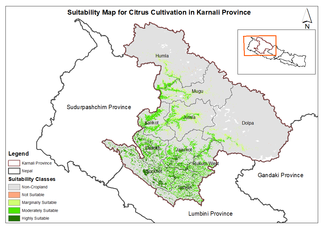
This dataset provides potential suitable area for cultivating citrus in the Karnali Province, Nepal. It is one of the datasets produced through a land suitability analysis conducted for high value agricultural commodities in the province. The suitability analysis was based on the FAO's' land suitability framework, which evaluates the suitability of land for cultivation of specific crop using climatic, topographic and soil characteristics. The analysis was conducted by ICIMOD under the Himalayan Resilience Enabling Action Programme (HI-REAP) project to support data-driven decision making and promote sustainable and climate-resilient agriculture in Karnali Province.
-
Digital table data of Livestock and livestock products of Koshi Basin. This dataset is compiled using data sources from Statistical information on Nepalese agriculture, MoAD(2012); Economic Survey (2011/2012), Government of Bihar, India.
-
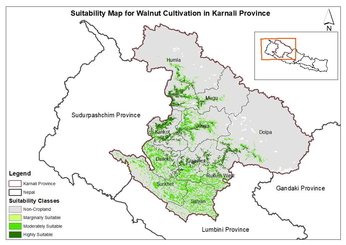
This dataset provides potential suitable area for cultivating walnut in the Karnali Province, Nepal. It is one of the datasets produced through a land suitability analysis conducted for high value agricultural commodities in the province. The suitability analysis was based on the FAO's' land suitability framework, which evaluates the suitability of land for cultivation of specific crop using climatic, topographic and soil characteristics. The analysis was conducted by ICIMOD under the Himalayan Resilience Enabling Action Programme (HI-REAP) project to support data-driven decision making and promote sustainable and climate-resilient agriculture in Karnali Province.
-
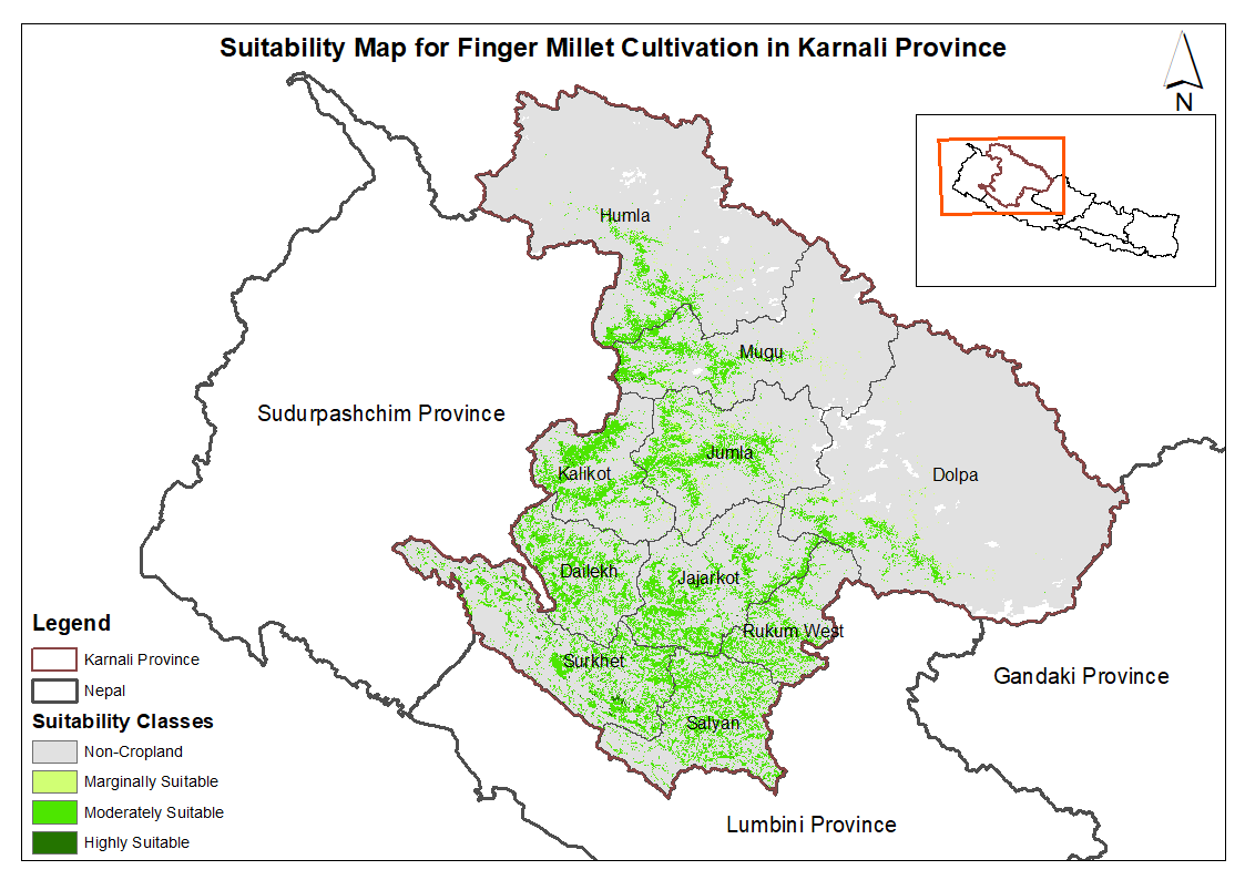
This dataset provides potential suitable area for cultivating finger millet in the Karnali Province, Nepal. It is one of the datasets produced through a land suitability analysis conducted for high value agricultural commodities in the province. The suitability analysis was based on the FAO's' land suitability framework, which evaluates the suitability of land for cultivation of specific crop using climatic, topographic and soil characteristics. The analysis was conducted by ICIMOD under the Himalayan Resilience Enabling Action Programme (HI-REAP) project to support data-driven decision making and promote sustainable and climate-resilient agriculture in Karnali Province.
-
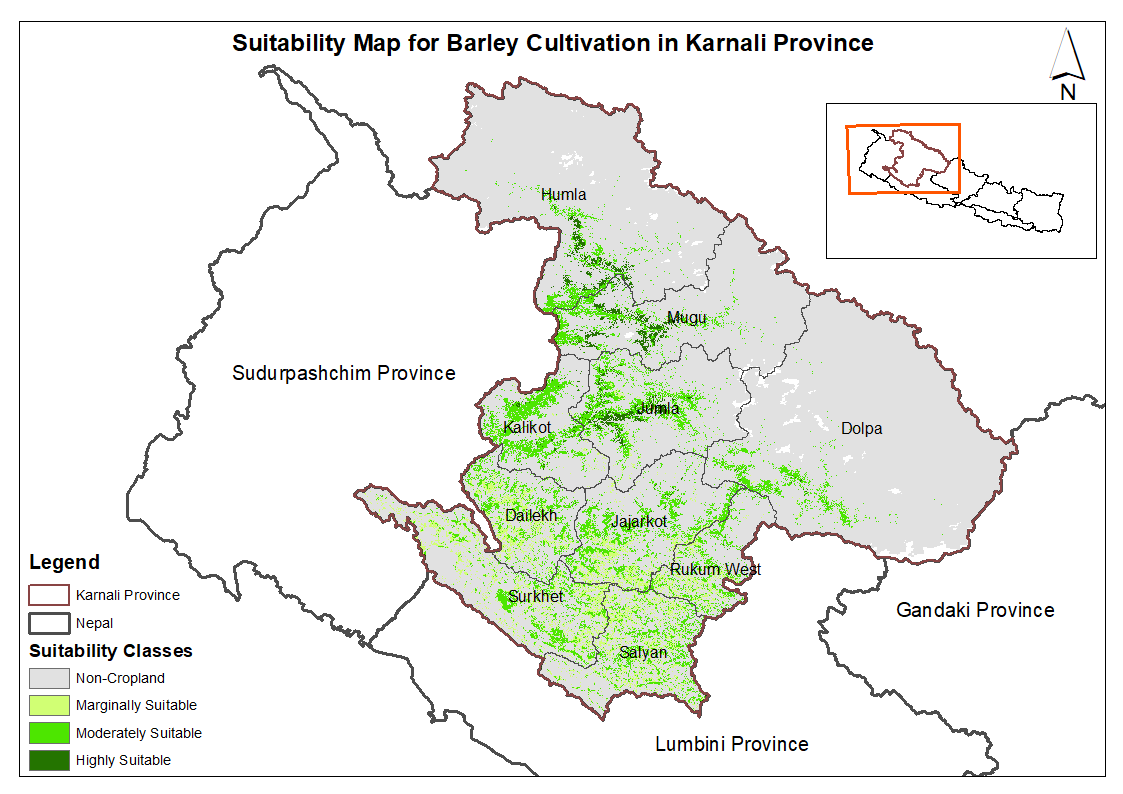
This dataset provides potential suitable area for cultivating barley in the Karnali Province, Nepal. It is one of the datasets produced through a land suitability analysis conducted for high value agricultural commodities in the province. The suitability analysis was based on the FAO's' land suitability framework, which evaluates the suitability of land for cultivation of specific crop using climatic, topographic and soil characteristics. The analysis was conducted by ICIMOD under the Himalayan Resilience Enabling Action Programme (HI-REAP) project to support data-driven decision making and promote sustainable and climate-resilient agriculture in Karnali Province.
-
Digital table data of Major Agricultural crop production of Koshi Basin. This dataset consists related to area and production of major agricultural crops such as cereals, vegetables, cash crops, oil-seed crops. The dataset is compiled using data sources from Statistical information on Nepalese agriculture, MoAD(2012); Economic Survey (2011/2012), Government of Bihar, India and IMHE Technical Report (2013).
-
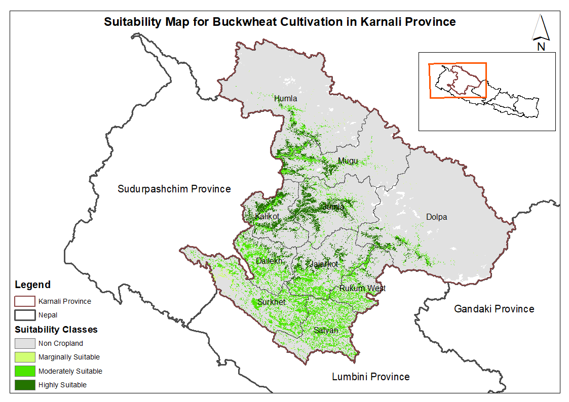
This dataset provides potential suitable area for cultivating buckwheat in the Karnali Province, Nepal. It is one of the datasets produced through a land suitability analysis conducted for high value agricultural commodities in the province. The suitability analysis was based on the FAO's' land suitability framework, which evaluates the suitability of land for cultivation of specific crop using climatic, topographic and soil characteristics. The analysis was conducted by ICIMOD under the Himalayan Resilience Enabling Action Programme (HI-REAP) project to support data-driven decision making and promote sustainable and climate-resilient agriculture in Karnali Province.