 Metadata Catalogue
FRTC
Type of resources
Topics
Keywords
Contact for the resource
Provided by
Representation types
Update frequencies
status
Resolution
-
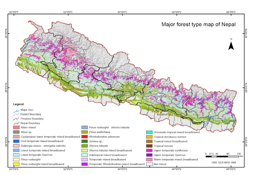
The dataset on forest types of Nepal for 2022 is jointly developed by the Forest Research and Training Centre (FRTC) and International Centre for Integrated Mountain Development (ICIMOD) with financial support from the World Bank under the "Sub-National Biophysical Forest Indicators for Sustainable Forest Management and Revenue Sharing in Nepal" project. The dataset has been prepared using freely available remote-sensing data (Sentinel 2) and a cloud-based machine learning algorithm in the Google Earth Engine (GEE) platform, field sampling methods, and extensive stakeholder consultations.
-
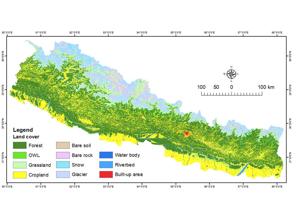
The annual land cover data of Nepal (2000-2022) have been created through the National Land Cover Monitoring System (NLCMS) for Nepal. The system uses freely available remote-sensing data (Landsat) and a cloud-based machine learning architecture in the Google Earth Engine (GEE) platform to generate land cover maps on an annual basis using a harmonized and consistent classification system. The NLCMS is developed by the Forest Research and Training Centre (FRTC), Ministry of Forests and Environment, Government of Nepal with support from the International Centre for Integrated Mountain Development (ICIMOD) through SERVIR Hindu Kush Himalaya (SERVIR-HKH), a joint initiative in partnership with the National Aeronautics and Space Administration (NASA) and the United States Agency for International Development (USAID). Collaborators include SERVIR–Mekong at the Asian Disaster Preparedness Center (ADPC), SilvaCarbon, Global Land Analysis and Discovery (GLAD) group at the University of Maryland, and the US Forest Service. The annual land cover data of Nepal for 2000-2019 was first published in 2022 while the data for 2020-2022 was released in 2024.