 Metadata Catalogue
Education
Type of resources
Available actions
Topics
Keywords
Contact for the resource
Provided by
Years
Representation types
Update frequencies
status
Scale
Resolution
-

Digital point dataset of Schools without Drinking Water access of Afghanistan. This dataset is basic vector layer derived from Afghanistan Information Management Systems (AIMS), Afghanistan.
-

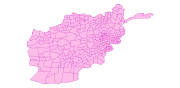
Digital polygon dataset of Type of Schools per District of Afghanistan. This dataset is basic Vector layer derived from Afghanistan Information Management Systems (AIMS), Afghanistan.
-
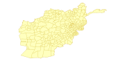
Digital polygon dataset of Total number of Students per District of Afghanistan. This dataset is basic Vector layer derived from Afghanistan Information Management Systems (AIMS), Afghanistan.
-

Digital point dataset of Education institutes of Central Karakoram National Park (CKNP) area, Pakistan. This dataset is compiled through GPS based field survey conducted in year 2008.
-
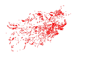
Digital point dataset of Location of Primary Schools of Afghanistan. This dataset is derived from Afghanistan Information Management Systems (AIMS), Afghanistan.
-
Digital polygon dataset of Students Teacher Ration per District of Afghanistan. This dataset is basic Vector layer derived from Afghanistan Information Management Systems (AIMS), Afghanistan.
-
The Poverty and Vulnerability Assessment (PVA) dataset was developed to capture the micro-level perspective of people's experiences with poverty and vulnerability and to monitor poverty and vulnerability trends on the ground. The assessment was based on a standardized questionnaire that has been developed to assess, describe, and analyse the situation of poor and vulnerable people in the HKH region. This will lead to an enhanced understanding of multiple aspects of livelihood assets, structures, and the processes that underpin such assets. It will also help determine levels of access, terms of exchange, and returns from livelihood assets as well as livelihood strategies and their outcomes for the poor.
-
The Poverty and Vulnerability Assessment Tool (PVAT) dataset was developed to capture the micro-level perspective of people's experiences with poverty and vulnerability and to monitor poverty and vulnerability trends on the ground. The assessment was based on a standardized questionnaire that has been developed to assess, describe, and analyse the situation of poor and vulnerable people in the Nepal. This will lead to an enhanced understanding of multiple aspects of livelihood assets, structures, and the processes that underpin such assets. It will also help determine levels of access, terms of exchange, and returns from livelihood assets as well as livelihood strategies and their outcomes for the poor. PVAT was conducted twice in 2011 and 2012. Sankhuwashava,Terthum, Saptari, Gorkha, Jajarkot, Kailali, Bajhang and Sindhupalchok in 2011. Taplejung, Bhojpur, Solukhumbu, Sindhuli, Rukum, Dailekh, Mugu and Darchula in 2012.