District
Type of resources
Topics
Keywords
Contact for the resource
Provided by
Representation types
Update frequencies
status
Scale
-
Digital polygon dataset of District Boundary of Pakistan. This dataset is created from Afghanistan Information Management Systems (AIMS), Afghanistan and ESRI Data and Maps 2001.
-
Digital line dataset of District Boundary of Afghanistan. This dataset is created using 1:1,000,000 scale map of Afghanistan and derived from Afghanistan Information Management Systems (AIMS), Afghanistan and ESRI Data and Maps 2001.
-
Digital polygon dataset of District boundary of Bhutan. This dataset is created using topographic sheet maps and is prepared by ICIMOD.
-
Digital polygon dataset of Population Distribution per District of Chittagong Hill Tracts of Bangladesh. This dataset is basic vector layer based on LGED Administrative Base Map and Bangladesh Bureau of Statistics (BBS) 2001.
-
Digital polygon dataset of District Boundary of Divang Valley, India. This dataset is created using Base map published Survey of India.
-
Digital polygon dataset of District Boundary of Chittagong Hill Tracts of Bangladesh. This dataset is basic vector layer based on LGED Administrative Base Map of Bangladesh.
-
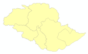
Digital polygon dataset of District boundary of Central Karakoram National Park(CKNP) area, Pakistan. This dataset is created using topographic sheet maps at scale of 20000.
-
Hazard, vulnerability and risk due to flood are calculated at Village Development Committee (VDC) level of Nepal. Hazard index has been calculated as an arithmetic sum of flood frequency, height above nearest drainage (HAND), river density and forest density. Vulnerability index is the function of population as an Exposure, Sensitivity (sex ratio, dependency ratio and child women ratio) and Resilience (road density, population in abroad, literacy, transport facility, etc). Then risk is the sum of hazard and vulnerability index.