 Metadata Catalogue
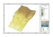
Digital Elevation Model
Type of resources
Available actions
Topics
Keywords
Contact for the resource
Provided by
Representation types
Update frequencies
status
Scale
Resolution
-
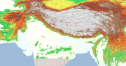
Digital Elevation Model (DEM) of Hindu Kush Himalayan (HKH) Region. This dataset is compiled from global SRTM DEM of 90 m resolution for HKH region and was prepared by ICIMOD.
-

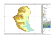
Digital Elevation Model (DEM) of Koshi Basin compiled from global SRTM DEM of 90 m resolution.
-
Digital Elevation Model of Gyoko, Nepal is based on Topographic map scale 1:25,000/50,000 acquired from National Geographic Information Infrastructure Project (NGIIP), Dept. of Survey Kathmandu Nepal.
-

The 5m ALOS DEM was procured from NTT DATA, a company serving as first point of sale of JAXA products.
-

The 5m ALOS DEM was procured from NTT DATA, a company serving as first point of sale of JAXA products.
-
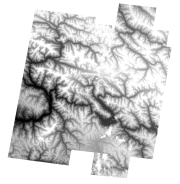
Digital Elevation Model (DEM) of 30 m resolution of Central Karakoram National Park(CKNP), Pakistan.
-
Digital Elevation Model (DEM) of Bhutan. This dataset is created using ASTER image with 30 m spatial resolution. The data was prepared for the analysis of attitudinal Variation and Land Cover Classes.
-
Digital grid data of Digital Elevation Model, DEM of Koshi Tappu Reserve, Nepal. This dataset is created using Topographic sheet data at scale of 25,000/50,000, of 1995 acquired from National Geographic Information Infrastructure Project (NGIIP), Dept. of Survey Kathmandu, Nepal.
-
Digital Elevation Model of Kayar Khola Watershed, Chitwan, Nepal. This dataset is created using Topographic sheet data at scale of 25,000/50,000, of 1995 acquired from National Geographic Information Infrastructure Project (NGIIP), Dept. of Survey, Nepal. The data was prepared for the Reducing Emission from Deforestation and Forest Degradation (REDD) Pilot Project. This is a joint project of ICIMOD with Asian Network for Sustainable Agriculture and Bio-resources (ANSAB) and Federation of Community for Forest Users of Nepal (FECOFUN) funded by NORAD.
-

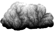
Digital Elevation Model (DEM) of the Kangchenjunga Landscape.