 Metadata Catalogue
Keyword
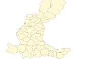
Dhading
Type of resources
Topics
Keywords
Contact for the resource
Provided by
Representation types
Update frequencies
status
Scale
From
1
-
2
/
2
-

Digital dataset of Land use of Dhading district, Nepal. This dataset is created using 1:50,000 scale Land use map of Land published by Land Resource Mapping Project (LRMP), Dept. of Survey, Nepal 1984.
-
Digital polygon dataset of Village Development Committee, VDC Boundary of Dhading district, Nepal. This dataset is created using 1:125,000 scale District Map published by Department of Survey, Nepal 1984.