 Metadata Catalogue
Community Forest
Type of resources
Topics
Keywords
Contact for the resource
Provided by
Representation types
Update frequencies
status
Scale
-
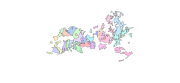
Digital polygon dataset of Community Forest Boundary of Ludhi Khola Watershed, Gorkha, Nepal. This dataset is created using GeoEye 0.5 meter spatial resolution satellite image of November 2009 and field verified in 2010. The data was prepared for the Reducing Emission from Deforestation and Forest Degradation (REDD) Pilot Project. This is a joint project of ICIMOD with Asian Network for Sustainable Agriculture and Bioresources (ANSAB) and Federation of Community for Forest Users of Nepal (FECOFUN) funded by NORAD.
-

Biophysical (Forest carbon) data of Community forest in Kayar Khola watershed, Nepal under a Pilot project “Design and setting up of a governance and payment system for Nepal’s Community Forest Management under Reduced Emission from Deforestation and Degradation (REDD)” implemented by ICIMOD and project partners ANSAB and FECOFUN. The pilot project aimed at setting up a benefit sharing mechanism in Community forest system.
-

Biophysical (Forest carbon) data of Community forest in Charnawati watershed, Nepal under “Design and setting up of a governance and payment system for Nepal’s Community Forest Management under Reduced Emission from Deforestation and Degradation (REDD)” project implemented by ICIMOD and project partners – ANSAB and FECOFUN. The pilot project aimed at setting up a benefit sharing mechanism in the community forest system.
-

Biophysical (Forest carbon) data of community forest in Ludi Khola watershed, Nepal under “Design and setting up of a governance and payment system for Nepal’s Community Forest Management under Reduced Emission from Deforestation and Degradation (REDD)” project implemented by ICIMOD and project partners – ANSAB and FECOFUN. The pilot project aimed at setting up a benefit sharing mechanism in the community forest system.