 Metadata Catalogue
Classification
Type of resources
Topics
Keywords
Contact for the resource
Provided by
Update frequencies
status
Resolution
-
Digital dataset of Land Cover change between 1990 and 2000 of Central Karakoram National Park (CKNP) area, Pakistan. This dataset is derived from the LandSat satellite imagery of 1990 and 2000 to show the change in land cover classes.
-
Digital dataset of Land Cover change between 2000 and 2010 of Central Karakoram National Park (CKNP) area, Pakistan. This dataset is derived from the LandSat satellite imagery of 2000 and 2010 to show the change in land cover classes.
-
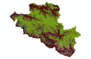
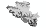
Digital dataset of Land Cover in 2000 of Central Karakoram National Park(CKNP) area, Pakistan. This dataset is extracted from LandSat satellite imagery of 2000 with spatial resolution of 30 m and spectral resolution of 6 bands. land cover classes are classified using Nearest Neighbor method.
-
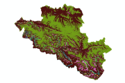
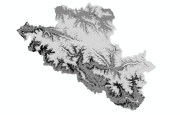
Digital dataset of Land Cover in 2010 of Central Karakoram National Park (CKNP) area, Pakistan. This dataset is extracted from LandSat satellite imagery of 2010 with spatial resolution of 30 m and spectral resolution of 6 bands. Land cover classes are classified using Nearest Neighbor method.