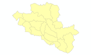
Central Karakoram National Park (CKNP)
Type of resources
Topics
Keywords
Contact for the resource
Provided by
Representation types
Update frequencies
status
Scale
Resolution
-

Digital point dataset of Camping sites locations of Central Karakoram National Park(CKNP) area, Pakistan. This dataset is compiled through GPS based field survey conducted in year 2008.
-

Digital polygon data of Floodplains of Central Karakoram National Park(CKNP) area, Pakistan. This dataset is compiled using water indices from satellite imagery
-

Digital point dataset of Education institutes of Central Karakoram National Park (CKNP) area, Pakistan. This dataset is compiled through GPS based field survey conducted in year 2008.
-

Digital polygon dataset of Watershed of Central Karakoram National Park(CKNP) area, Pakistan. This dataset is derived from 30 meter spatial resolution ASTER DEM.
-

Digital point data of Bank locations in Central Karakoram National Park (CKNP) area, Pakistan. The dataset is compiled through GPS based field survey conducted in year 2008.
-

Digital point dataset of Check post location of Central Karakoram National Park(CKNP) area, Pakistan. This dataset is compiled through GPS based field survey conducted in year 2008.
-

Digital point dataset of Hotels of Central Karakoram National Park(CKNP) area, Pakistan. This dataset is compiled through GPS based field survey conducted in year 2008.
-

Digital point dataset of Settlements of Central Karakoram National Park(CKNP) area, Pakistan. This dataset is created from topographic sheet maps at scale of 20000 and GPS based field survey conducted in year 2008.
-

Digital point dataset of Tourist Facilities locations of Central Karakoram National Park(CKNP) area, Pakistan. This dataset is compiled through GPS based field survey conducted in year 2008.
-

Digital point dataset of Gemstone Mine locations of Central Karakoram National Park(CKNP) area, Pakistan. This dataset is compiled through GPS based field survey conducted in year 2008.
 Metadata Catalogue