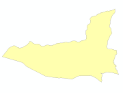
Boundary
Type of resources
Available actions
Topics
Keywords
Contact for the resource
Provided by
Years
Representation types
Update frequencies
status
Scale
Resolution
-
Boundary(polygon) dataset of Bhaktapur Municipality for the Geo-visualization on emergency response in case of earthquake disaster.
-
Boundary(polygon) dataset of Kritipur Municipality for the Geo-visualization on emergency response in case of earthquake disaster.
-
Boundary(polygon) dataset of Lalitpur Municipality for the Geo-visualization on emergency response in case of earthquake disaster.
-
Boundary(polygon) dataset of Kathmandu Metropolitian City for the Geo-visualization on emergency response in case of earthquake disaster.
-
Administrative boundaries of Bhutan.
-
The province layer shows the administrative boundaries of 34 provinces across the country.
-
Digital polygon dataset of Country boundary of Bhutan. This dataset is created using topographic sheet maps at scale of 50000 and prepared by ICIMOD.
-
Digital polygon data of Boundary Area of RDT Centre of Bhutan. This dataset is prepared by ICIMOD based on data provided by RDT Centre in 2008.
-
Digital polygon data of Country Boundary of Nepal. This dataset is created using Topographic Zonal Map of 250000 scale published by Department of Survey Nepal in 1988 and is in geographic coordinates.
-
This layer gives information about the village boundary of Nepal that lies in Kailash Sacred Landscape.