 Metadata Catalogue
Bhaktapur, Kathmandu, Nepal
Type of resources
Keywords
Contact for the resource
Provided by
Representation types
Update frequencies
status
Scale
-
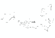
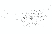
Trees(point) dataset of Bhaktapur Municipality for the Geo-visualization on emergency response in case of earthquake disaster.
-
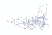
Transportation road(polyline) dataset of Bhaktapur Municipality for the Geo-visualization on emergency response in case of earthquake disaster.
-
Sewerage line(polyline) dataset of Bhaktapur Municipality for the Geo-visualization on emergency response in case of earthquake disaster.
-
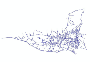
Road edge(polyline) dataset of Bhaktapur Municipality for the Geo-visualization on emergency response in case of earthquake disaster.
-

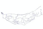
Courtyard(polygon) dataset of Bhaktapur Municipality for the Geo-visualization on emergency response in case of earthquake disaster.
-
Building footprint(point) dataset of Bhaktapur Municipality for the Geo-visualization on emergency response in case of earthquake disaster.
-
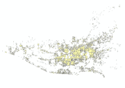
Buildings (polygon) dataset of Bhaktapur Municipality for the Geo-visualization on emergency response in case of earthquake disaster.
-

Electric line(polyline) dataset of Bhaktapur Municipality for the Geo-visualization on emergency response in case of earthquake disaster.
-

Place name(point) dataset of Bhaktapur Municipality for the Geo-visualization on emergency response in case of earthquake disaster.
-

Sewerage point(point) dataset of Bhaktapur Municipality for the Geo-visualization on emergency response in case of earthquake disaster.