 Metadata Catalogue
50000
Type of resources
Available actions
Topics
Keywords
Contact for the resource
Provided by
Years
Representation types
Update frequencies
status
Scale
Resolution
-

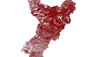
Landslide data of Koshi basin is digitized from topo sheets published in 1990s.
-

Glacier data of Afghanistan were prepared on the basis of Landsat imageries from 2010. The glacier outlines were derived semi-automatically using object-based image classification (OBIC) separately for clean-ice and debris-covered glaciers and further manual editing for quality assurance. The attributes of glacier data were derived from SRTM DEM. This dataset was jointly prepared by the Ministry of Energy and Water (MEW), Government of Afghanistan, and ICIMOD under the SERVIR-HKH Initiative.
-

Digital polygon dataset of Glacial Lakes of Sagarmatha National Park, SNP Nepal. This dataset is extracted from inventory of glaciers and glacial lakes prepared by ICIMOD, 2002.
-

Digital point data of Education institutions location of Sagarmatha National Park, Nepal. This dataset is created using Topographic sheet data at scale of 25,000/50,000, of 1995 acquired from National Geographic Information Infrastructure Project (NGIIP), Dept. of Survey, Nepal and Tourist maps published by various map publishing companies.
-
This is the first inventory of glaciers of Nepal Himalaya. The data is prepared using topographic maps, aerial photographs and satellite images.
-
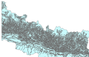
This Contour (line) digital data of Gorkha district was prepared based on Indian toposheet enlarge(1:50,000) and contour interval is 500 feet.
-

Digital polygon dataset of Hotels and Lodges of Sagarmatha National Park, Nepal. This dataset is created using Topographic sheet data at scale of 25,000/50,000, of 1995 acquired from National Geographic Information Infrastructure Project (NGIIP), Dept. of Survey, Nepal and Tourist maps published by various map publishing companies.
-
Digital polygon data of Glaciers of Bhutan in 1990. This dataset is created using Landsat MSS, imageries of 1990. The glacier outlines was derived semi-automatically using object-based image classification (OBIC ) method separately for clean ice and debris cover and further editing and validation was done carefully by draping over the high resolution images from Google Earth.
-
Topographical thematic Vector digital data of Nepal based on Land Reource Mapping Project (LRMP), Dept. of Survey, 1984
-

Land cover data of Hindu Kush Himalayan region of Myanmar for 2010. This dataset is created using the LandSat 30 meter spatial resolution satellite image of 2010 and includes land cover information for Chin, Kachin, Rakhine and Shan states of Myanmar.