 Metadata Catalogue
250000
Type of resources
Topics
Keywords
Contact for the resource
Provided by
Representation types
Update frequencies
status
Scale
-
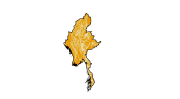
Digital polygon data of Geology of Myanmar. This dataset is created using 1:250,000 scale map of Myanmar published by Department of Survey of Myanmar.
-
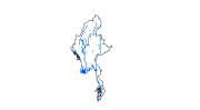
Digital line data of Major River systems of Myanmar. This dataset is created using 1:250,000 scale map of Myanmar published by Department of Survey of Myanmar.
-
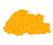
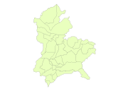
Digital polygon dataset of District boundary of Bhutan. This dataset is created using topographic sheet maps and is prepared by ICIMOD.
-

Digital point dataset of Location of Settlements of Divang Valley, India. This dataset is created using Base map published Survey of India.
-
Digital point dataset of Location of Settlements of Divang Valley, India. This dataset is created using Base map published Digital po
-

Digital line dataset of Location of Reserve Forest area of Divang Valley, India. This dataset is created using Base map published Survey of India.
-
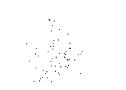
Digital point dataset of Location of Settlements of Core area of Divang Valley, India. This dataset is created using Base map published Survey of India.
-
Digital polygon dataset of Village Boundary of Divang Valley, India. This dataset is created using Base map published Survey of India.
-
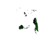
Digital polygon dataset of Forest area of Bangladesh. This dataset is basic vector layer based on LGED Administrative Base Map of Bangladesh.
-
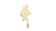
Digital polygon data of Soils of Myanmar. This dataset is created using 1:250,000 scale map of Myanmar published by Department of Survey of Myanmar.