100000
Type of resources
Available actions
Topics
Keywords
Contact for the resource
Provided by
Years
Representation types
Update frequencies
status
Scale
-
This Layer shows five major water basins (Norther Basin, Hari Rod-Lower, South Eastern Basin, Northern Basin, Helmand Basin and Nondranage areas in Southern part of Afghanistan.
-

Digital point dataset of Earthquake Incident Locations of Afghanistan. This dataset is derived from Afghanistan Information Management Systems (AIMS), Afghanistan.
-

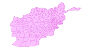
Digital polygon dataset of Students per District population of Afghanistan. This dataset is basic Vector layer derived from Afghanistan Information Management Systems (AIMS), Afghanistan.
-

Digital polygon dataset of Location of Education institutions per District of Afghanistan. This dataset is basic Vector layer acquired from ESRI Data and Maps, 2001 and derived from Afghanistan Information Management Systems (AIMS), Afghanistan.
-

This dataset shows the proposed conservation corridors of the Kangchenjunga Landscape.
-

Digital point dataset of Location Protected Areas of Afghanistan. This dataset is created using 1:1,000,000 scale map of Afghanistan and derived from Afghanistan Information Management Systems (AIMS), Afghanistan.
-

Digital polygon dataset of Cultivated land of Afghanistan. This dataset is created using 1:1,000,000 scale map of Afghanistan and derived from Afghanistan Information Management Systems (AIMS), Afghanistan.
-

Digital polygon dataset of Type of Schools per District of Afghanistan. This dataset is basic Vector layer derived from Afghanistan Information Management Systems (AIMS), Afghanistan.
-

Administrative boundaries of Bhutan.
-

The HKH Region Climate data were derived from WorldClim(http://www.worldclim.org/), This map layer shows precipitation of driest quarter for the period of 1950-2000.
 Metadata Catalogue