 Metadata Catalogue
notPlanned
Type of resources
Available actions
Topics
Keywords
Contact for the resource
Provided by
Representation types
Update frequencies
status
Scale
Resolution
-

Landslide data of Koshi basin is digitized from topo sheets published in 1990s.
-

Digital polygon data of Floodplains of Central Karakoram National Park(CKNP) area, Pakistan. This dataset is compiled using water indices from satellite imagery
-

Digital point dataset of Graveyards of Central Karakoram National Park(CKNP)area, Pakistan. This dataset is compiled through GPS based field survey conducted in year 2008.
-
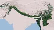
Compiled MODIS Active fire dataset of HKH region derived from FIRMS (Fire Information for Resource Management System). The data shows the locations of fire incidents within HKH region on various dates in the period between 2000 to 2010 along with the confidence level information of such incidents.
-

Airport dataset(point) compiled through GPS based field survey conducted in year 2008 of Central Karakoram National Park(CKNP), Pakistan.
-

Digital dataset of Himalayan Ibex habitat area of Central Karakoram National Park (CKNP) area, Pakistan. This dataset is compiled through GPS based field survey conducted in year 2008 based on baseline study volume II, draft report, by Hagler Bailly (2005) and TJ Roberts. Habitat area is identified based on the GPS survey, baseline report and potential habitat area modeling using variables like land cover, slope, DEM etc through ENFA.
-
Digital dataset of Land Cover change between 1990 and 2000 of Central Karakoram National Park (CKNP) area, Pakistan. This dataset is derived from the LandSat satellite imagery of 1990 and 2000 to show the change in land cover classes.
-
Digital polygon data of Glaciers of Bhutan in 1990. This dataset is created using Landsat MSS, imageries of 1990. The glacier outlines was derived semi-automatically using object-based image classification (OBIC ) method separately for clean ice and debris cover and further editing and validation was done carefully by draping over the high resolution images from Google Earth.
-

Digital point dataset of Mountain Passes of Central Karakoram National Park (CKNP) area, Pakistan. This dataset is created from topographic sheet maps at scale of 20000. Created dataset is verified through DEM.
-

Digital line dataset of Road network of Central Karakoram National Park(CKNP) area, Pakistan. This dataset is created from topographic sheet maps at scale of 20000 and verified using DEM.