 Metadata Catalogue
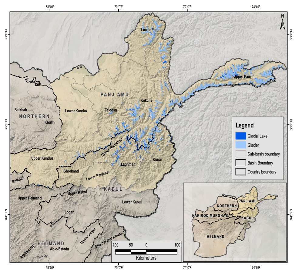
Glacial lake of Afghanistan 2000
The glacial lakes of Afghanistan were mapped using Landsat image that were selected based in a one-year buffer surrounding a representative year. For instance, the Landsat images from 1999 to 2001 were used to represent 2000 depending on the quality of images (least snow cover and cloud cover). The glacial lakes were extracted semi-automatically through an object-based image classification (OBIC) method and were then subjected to manual editing for quality control. The attributes of the data were extracted from the SRTM DEM. This dataset was produced in collaboration between the National Water Affairs Regulation Authority (NWARA) of the Government of Afghanistan and ICIMOD as part of the SERVIR-HKH Initiative.
Simple
- Date ( Creation )
- 2021-01-01
- Other citation details
- ICIMOD. (2023). Glacial lake of Afghanistan 2000 [Data set]. ICIMOD. https://doi.org/10.26066/RDS.1973404
- Purpose
- This data provides the status and baseline information of glacial lakes to the researchers, scientists and policy makers for water resource management, impact of climate change study, glacial hazard and risk reduction, and mitigation measures.
- Status
- Required
- Maintenance and update frequency
- As needed
- ( Theme )
-
- Glacial lake
- Glacier
- Cryosphere
- Keywords ( Place )
-
- Afghanistan
- Amu Darya
- Kabul
- Indus
- Use limitation
- Creative Commons Attribution 4.0 International (CC BY 4.0)
- Access constraints
- License
- Use constraints
- License
- Spatial representation type
- Vector
- Denominator
- 50000
- Metadata language
- eng
- Character set
- UTF8
- Topic category
-
- Geoscientific information
N
S
E
W
))
- OnLine resource
- Glacial Lakes in Afghanistan ( Glacial Lakes in Afghanistan )
- OnLine resource
- Monitoring of Glaciers and Glacial Lakes in Afghanistan ( Monitoring of Glaciers and Glacial Lakes in Afghanistan )
- Hierarchy level
- Dataset
- File identifier
- eddcc797-fb42-48b0-aad6-9f325627a8ba XML
- Metadata language
- eng
- Character set
- UTF8
- Hierarchy level
- Dataset
- Date stamp
- 2026-01-30T12:19:38
- Metadata standard name
- North American Profile of ISO-19115:2003
Overviews
Spatial extent
N
S
E
W
Provided by

Associated resources
Not available