 Metadata Catalogue
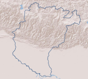
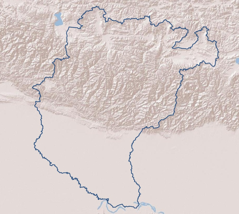
Basin Boundary of Koshi River Basin
Digital line dataset of Basin Boundary of Koshi Basin. This dataset is created using Topographic sheet data at scale of 25,000/50,000, of 1995 acquired from National Geographic Information Infrastructure Project (NGIIP), Dept. of Survey, Kathmandu, Nepal and ESRI Global dataset.
Simple
- Date ( Publication )
- 2013-06-13T14:23:00
- Edition
- First
- Identifier
- np
- Presentation form
- Digital image
- Other citation details
- ICIMOD. (2013). Basin Boundary of Koshi River Basin [Data set]. ICIMOD. https://doi.org/10.26066/RDS.9182
- Purpose
- Topographic base data for general purpose and water resource inventory
- Status
- Completed
Author
ICIMOD
-
Sameer Bajracharya
(
Research Associate GIS
)
977 1 5003299
ICIMOD
,
Kathmandu
,
Khumaltar, Lalitpur
,
GPO Box 3226
,
Nepal
977-1-5275222
977 1 5003299
- Maintenance and update frequency
- As needed
- Keywords ( Theme )
-
- Basin Boundary
- Watershed
- Water resource management
- Keywords ( Place )
-
- Koshi Basin
- Nepal
- India
- China
- Use limitation
- Creative Commons Attribution 4.0 International (CC BY 4.0)
- Access constraints
- License
- Use constraints
- License
- Spatial representation type
- Vector
- Denominator
- 50000
- Metadata language
- eng
- Character set
- UTF8
- Topic category
-
- Boundaries
N
S
E
W
))
- Reference system identifier
- WGS 1984
- OnLine resource
-
Data Download
(
WWW:LINK-1.0-http--related
)
Data Download
- Hierarchy level
- Attribute type
- Statement
- The accuracy of the Digital Data prepared depends on the base source Data and Maps. No assessment or ground truthing has been carried out on this data. ICIMOD accepts no responsibility for any inaccuracy, errors, or omissions in this data.
- File identifier
- e2fd0359-c241-4dcb-8f33-b2a6761c31dd XML
- Metadata language
- eng
- Character set
- UTF8
- Date stamp
- 2026-01-29T09:28:45
- Metadata standard name
- ISO 19115:2003/19139
- Metadata standard version
- 1.0
Author
ICIMOD
-
Mr. Govinda Joshi
(
Senior Cartographer/GIS Analyst
)
977 1 5003299
ICIMOD
,
Kathmandu
,
Khumaltar lalitpur
,
GPO Box 3226
,
Nepal
977-1-5275222
977 1 5003299
Overviews
thumbnail
large_thumbnail
Spatial extent
N
S
E
W
Provided by

Associated resources
Not available