 Metadata Catalogue
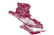
Contours of Dang and Salyan District Nepal
Digital line dataset of Elevation Contours of Dang and Salyan district, Nepal. This dataset is created using Topographic sheet data at scale of 50,000, of 1995 acquired from Department of Survey, Kathmandu, Nepal. Contour interval is 500 feet.
Simple
- Date ( Publication )
- 2007-10-19
- Edition
- ICIMOD
- Identifier
- Salyan and Dang, NP
- Purpose
- Topographic base data for general purpose
- Status
- Completed
Point of contact
ICIMOD
-
(
)
977-1-5003299
Khumaltar
,
Lalitpur
,
Kathmandu
,
3226
,
Nepal
977-1-5275222
977-1-5003299
- Maintenance and update frequency
- As needed
- Keywords ( Theme )
-
- Contour
- Elevation
- Topography
- Keywords ( Place )
-
- Salyan
- Dang
- Nepal
- Access constraints
- Copyright
- Use constraints
- Other restrictions
- Other constraints
- The content of this website can be accessed, printed and downloaded in an unaltered form (altered including being stretched, compressed, coloured or altered in any way so as to distort content from its original proportions or format) with copyright acknowledged, on a temporary basis for personal study that is not for a direct or indirect commercial use and any non-commercial use. Any content printed or downloaded may not be sold, licensed, transferred, copied or reproduced in whole or in part in any manner or in or on any media to any person without the prior written consent of the ICIMOD
- Spatial representation type
- Vector
- Denominator
- 50000
- Metadata language
- eng
- Character set
- UTF8
- Topic category
-
- Elevation
N
S
E
W
))
- Supplemental Information
- Data Source: Indian toposheet (Scale 1:50,000 enlarged of one inch to one mile) map acquired from Dept. of Survey, Kathmandu, Nepal. Projection: UTM, Spheroid: Everest.
- Reference system identifier
- Clarke 1866
Distributor
ICIMOD
-
Mr. Govinda Joshi
(
Sr. Cartographer/GIS Analyst
)
977-1-5003299
Khumaltar
,
Lalitpur
,
Kathmandu
,
3226
,
Nepal
977-1-5275222
977-1-5003299
- Hierarchy level
- Dataset
- Statement
- The accuracy of the Digital Data prepared depends on the base source Data and Maps. No assessment or ground truthing has been carried out on this data. ICIMOD accepts no responsibility for any inaccuracy, errors, or omissions in this data.
- File identifier
- d7047262-d581-43ce-8dd6-2cafd7ccb2a0 XML
- Metadata language
- eng
- Character set
- UTF8
- Date stamp
- 2020-09-08T13:59:58
- Metadata standard name
- ISO 19115:2003/19139
- Metadata standard version
- 1.0
Point of contact
ICIMOD
-
(
)
977-1-5003299
Khumaltar
,
Lalitpur
,
Kathmandu
,
3226
,
Nepal
977-1-5275222
977-1-5003299
Overviews
thumbnail

large_thumbnail
Spatial extent
N
S
E
W
Provided by

Associated resources
Not available