 Metadata Catalogue
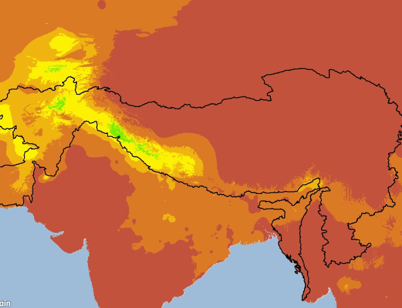
Precipitation of HKH Region for January.
The HKH Region Climate data were derived from WorldClim(http://www.worldclim.org/), This map layer shows monthly precipitation, for the period of 1950-2000. The data layers were generated through interpolation of average monthly climate data from weather stations on a 30 arc-second resolution grid. Major climate databases compiled by the Global Historical Climatology Network(GHCN),the FAO, the WMO, the International Center for Tropical Agriculture (CIAT), R-HYdronet.
Monthly Precipitation data set consists of 12 raster files, one for each month, showing mean values derived from monthly precipitation readings.
Simple
- Date ( Publication )
- 2011-07-04T14:22:00
- Edition
- First
- Identifier
- np
- Presentation form
- Digital image
- Purpose
- These data are intended for geographic display and analysis for HKH region.
- Status
- Completed
Originator
ICIMOD
-
(
)
977 1 5003299
ICIMOD
,
Kathmandu
,
Khumaltar lalitpur
,
GPO Box 3226
,
Nepal
977 1 5275222
977 1 5003299
- Maintenance and update frequency
- As needed
- Keywords ( Theme )
-
- Precipitation, Climate
- Keywords ( Place )
-
- HKH
- Access constraints
- Copyright
- Use constraints
- Other restrictions
- Other constraints
- The content of this website can be accessed, printed and downloaded in an unaltered form (altered including being stretched, compressed, coloured or altered in any way so as to distort content from its original proportions or format) with copyright acknowledged, on a temporary basis for personal study that is not for a direct or indirect commercial use and any non-commercial use. Any content printed or downloaded may not be sold, licensed, transferred, copied or reproduced in whole or in part in any manner or in or on any media to any person without the prior written consent of the ICIMOD
- Spatial representation type
- Grid
- Denominator
- 100000
- Metadata language
- eng
- Character set
- UTF8
- Topic category
-
- Climatology, meteorology, atmosphere
N
S
E
W
))
- Supplemental Information
- The database is documented in this article: Hijmans, R.J., S.E. Cameron, J.L. Parra, P.G. Jones and A. Jarvis, 2005. Very high resolution interpolated climate surfaces for global land areas. International Journal of Climatology 25: 1965-1978.
- Reference system identifier
- WGS 1984
- Protocol
- WWW:LINK-1.0-http--link
- Hierarchy level
- Attribute type
- File identifier
- c38464e1-be53-414f-84cc-63f5aa603278 XML
- Metadata language
- eng
- Character set
- UTF8
- Date stamp
- 2020-09-08T14:02:38
- Metadata standard name
- ISO 19115:2003/19139
- Metadata standard version
- 1.0
Author
ICIMOD
-
(
GIS Specialist
)
977 1 5003299
ICIMOD
,
Kathmandu
,
Khumaltar lalitpur
,
GPO Box 3226
,
Nepal
977 1 5275222
977 1 5003299
Overviews

thumbnail
large_thumbnail
Spatial extent
N
S
E
W
Provided by

Associated resources
Not available