 Metadata Catalogue
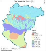
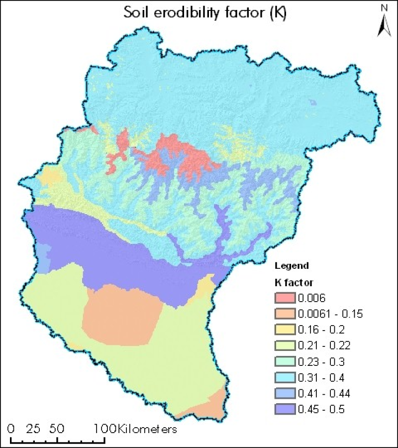
Soil erodibility factor of Koshi basin
Digital polygon dataset of soil erosivity on Koshi Basin. The dataset is created using Soil maps of Nepal, India and FAO and represents the average long term soil response to the erosive power associated with rainfall and runoff. It shows a measure of the susceptibility of soil particles to detachment and transport by rainfall and runoff.
Simple
- Date ( Publication )
- 2013-06-13T15:39:00
- Edition
- First
- Identifier
- np
- Presentation form
- Digital image
- Purpose
- Topographic Base data to generate erosion estimates at sub basin and basin level
- Status
- Completed
Originator
ICIMOD
-
(
)
977 1 5003299
ICIMOD
,
Kathmandu
,
Khumaltar lalitpur
,
GPO Box 3226
,
Nepal
977-1-5275222
977 1 5003299
- Maintenance and update frequency
- As needed
- Keywords ( Theme )
-
- Soil erosivity
- Basin
- Keywords ( Place )
-
- Koshi
- Nepal
- China
- India
- Access constraints
- Copyright
- Use constraints
- Other restrictions
- Other constraints
- The content of this website can be accessed, printed and downloaded in an unaltered form (altered including being stretched, compressed, coloured or altered in any way so as to distort content from its original proportions or format) with copyright acknowledged, on a temporary basis for personal study that is not for a direct or indirect commercial use and any non-commercial use. Any content printed or downloaded may not be sold, licensed, transferred, copied or reproduced in whole or in part in any manner or in or on any media to any person without the prior written consent of the ICIMOD
- Spatial representation type
- Vector
- Denominator
- 100000
- Metadata language
- eng
- Character set
- UTF8
- Topic category
-
- Environment
N
S
E
W
))
- Supplemental Information
- Soil map of Nepal, India and FAO
- Reference system identifier
- WGS 1984
- Hierarchy level
- Attribute type
- Statement
- The accuracy of the Digital Data prepared depends on the base source Data and Maps. No assessment or ground truthing has been carried out on this data. ICIMOD accepts no responsibility for any inaccuracy, errors, or omissions in this data.
- File identifier
- 91cde8f2-5de9-4a4f-ba64-ab4feb1a76bc XML
- Metadata language
- eng
- Character set
- UTF8
- Date stamp
- 2020-09-08T15:22:08
- Metadata standard name
- ISO 19115:2003/19139
- Metadata standard version
- 1.0
Author
ICIMOD
-
(
)
977 1 5003299
ICIMOD
,
Kathmandu
,
Khumaltar lalitpur
,
GPO Box 3226
,
Nepal
977-1-5275222
977 1 5003299
Overviews
thumbnail
large_thumbnail
Spatial extent
N
S
E
W
Provided by

Associated resources
Not available