 Metadata Catalogue
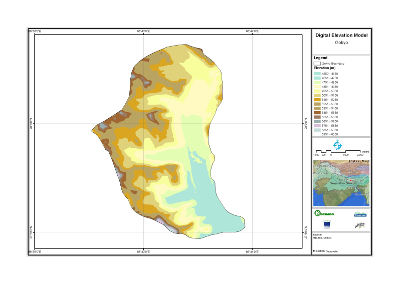
Digital Elevation Model for Gokyo Nepal
Digital Elevation Model of Gyoko, Nepal is based on Topographic map scale 1:25,000/50,000 acquired from National Geographic Information Infrastructure Project (NGIIP), Dept. of Survey Kathmandu Nepal.
Simple
- Date ( Publication )
- 2011-07-15T11:00:00
- Edition
- First
- Presentation form
- Digital map
- Purpose
- Topographic base data for visualization and analysis purpose
- Status
- On going
- Maintenance and update frequency
- As needed
- Keywords ( Theme )
-
- Digital Elevation Model
- Topography
- Digital Terrain Model
- Keywords ( Place )
-
- Nepal
- Access constraints
- Copyright
- Use constraints
- Other restrictions
- Other constraints
- The content of this website can be accessed, printed and downloaded in an unaltered form (altered including being stretched, compressed, coloured or altered in any way so as to distort content from its original proportions or format) with copyright acknowledged, on a temporary basis for personal study that is not for a direct or indirect commercial use and any non-commercial use. Any content printed or downloaded may not be sold, licensed, transferred, copied or reproduced in whole or in part in any manner or in or on any media to any person without the prior written consent of the ICIMOD
- Spatial representation type
- Vector
- Denominator
- 50000
- Metadata language
- eng
- Character set
- UTF8
- Topic category
-
- Elevation
N
S
E
W
))
- Reference system identifier
- WGS 1984
- Protocol
- WWW:LINK-1.0-http--link
- Hierarchy level
- Dataset
- File identifier
- 5e53e877-bb38-4cf3-864b-6f47b77ebd2e XML
- Metadata language
- eng
- Character set
- UTF8
- Date stamp
- 2020-09-08T13:59:53
- Metadata standard name
- ISO 19115:2003/19139
- Metadata standard version
- 1.0
Distributor
ICIMOD
-
(
)
977-1-5003299
Khumaltar
,
Lalitpur
,
Kathmandu
,
3226
,
Nepal
977-1-5275222
977-1-5003299
Overviews

thumbnail
large_thumbnail
Spatial extent
N
S
E
W
Provided by

Associated resources
Not available