 Metadata Catalogue
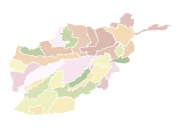
River Basins of Afghanistan
Digital polygon dataset of River Basins of Afghanistan. This dataset is basic vector layer derived from Afghanistan Information Management Systems (AIMS), Afghanistan.
Simple
- Date ( Publication )
- 2008-05-21T12:45:00
- Edition
- First
- Identifier
- af
- Purpose
- Topographic base data for general purpose
- Status
- Completed
Point of contact
ICIMOD
-
(
)
977-1-5003299
Khumaltar
,
Lalitpur
,
Kathmandu
,
3226
,
Nepal
977-1-5275222
977-1-5003299
- Maintenance and update frequency
- As needed
- Keywords ( Theme )
-
- River Basin
- Watershed
- Water resource management
- Keywords ( Place )
-
- Afghanistan
- Access constraints
- Copyright
- Use constraints
- Other restrictions
- Other constraints
- The content of this website can be accessed, printed and downloaded in an unaltered form (altered including being stretched, compressed, coloured or altered in any way so as to distort content from its original proportions or format) with copyright acknowledged, on a temporary basis for personal study that is not for a direct or indirect commercial use and any non-commercial use. Any content printed or downloaded may not be sold, licensed, transferred, copied or reproduced in whole or in part in any manner or in or on any media to any person without the prior written consent of the ICIMOD
- Spatial representation type
- Vector
- Denominator
- 1000000
- Metadata language
- eng
- Character set
- UTF8
- Topic category
-
- Inland waters
N
S
E
W
))
- Supplemental Information
-
Projection: GCS_Assumed_Geographic_1
Geodetic Model
Ellipsoid Name: Clarke 1866
Semi-major Axis: 6378206.400000
Denominator of Flattening Ratio: 294.978698
Geographic Coordinate System
Latitude Resolution: 0.000000
Longitude Resolution: 0.000000
Geographic Coordinate Units: Decimal degrees
- Reference system identifier
- Clarke 1866
Distributor
ICIMOD
-
Mr. Govinda Joshi
(
Sr. Cartographer/GIS Analyst
)
977-1-5003299
Khumaltar
,
Lalitpur
,
Kathmandu
,
3226
,
Nepal
977-1-5275222
977-1-5003299
- Hierarchy level
- Dataset
- Statement
- The accuracy of the Digital Data prepared depends on the base source Data and Maps. No assessment or ground truthing has been carried out on this data. ICIMOD accepts no responsibility for any inaccuracy, errors, or omissions in this data.
- File identifier
- 5b18d216-0858-4f29-8649-9a8cd3a0a059 XML
- Metadata language
- eng
- Character set
- UTF8
- Date stamp
- 2020-09-08T14:01:39
- Metadata standard name
- ISO 19115:2003/19139
- Metadata standard version
- 1.0
Point of contact
ICIMOD
-
(
)
977-1-5003299
Khumaltar
,
Lalitpur
,
Kathmandu
,
3226
,
Nepal
977-1-5275222
977-1-5003299
Overviews
thumbnail

large_thumbnail
Spatial extent
N
S
E
W
Provided by

Associated resources
Not available