Metadata Catalogue
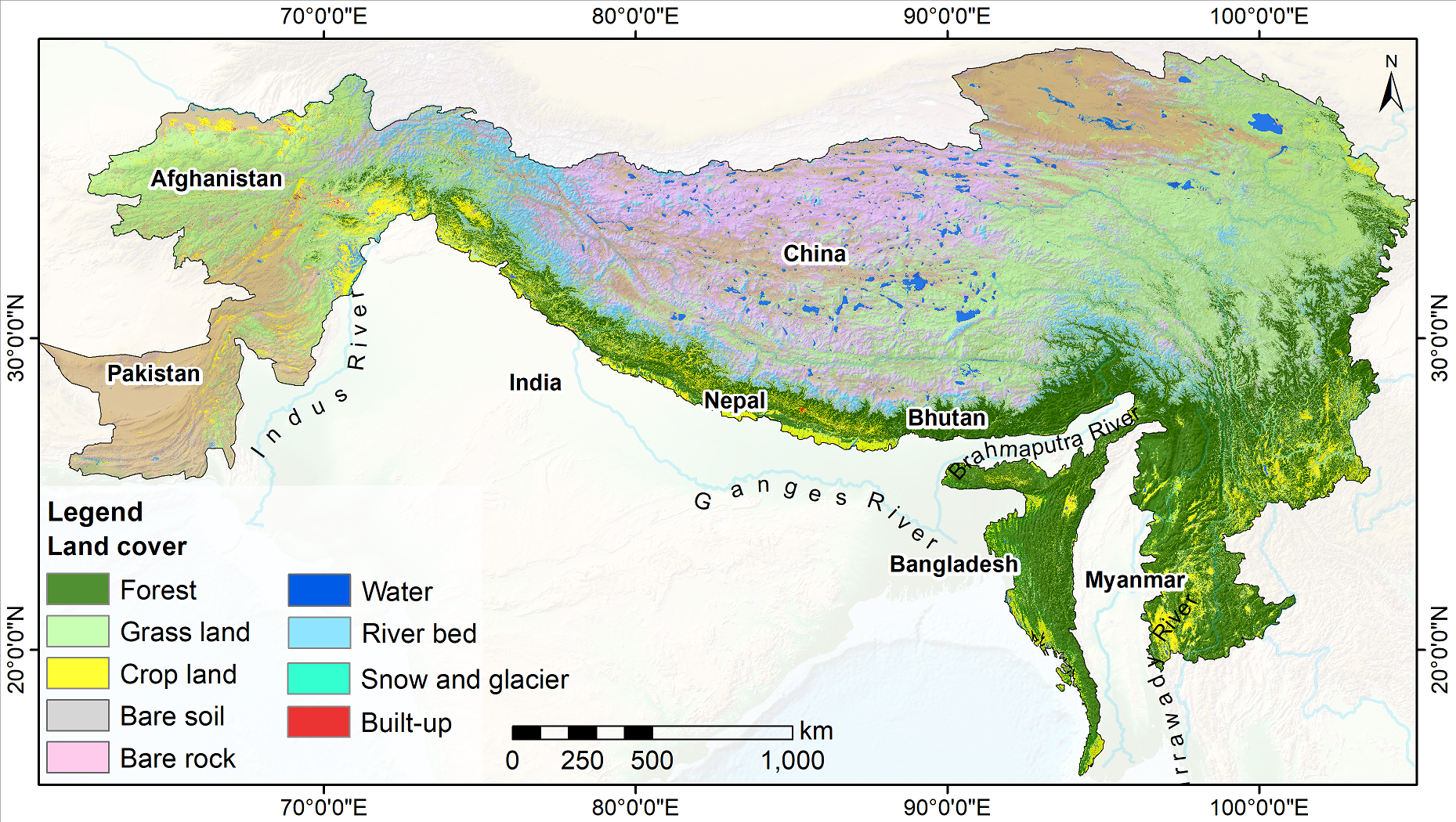
Land cover of HKH region
Land cover change is a significant contributor to environmental change. The degradation of forests and conversion of natural areas, forests, and farmlands to other land use impact ecosystem services and biodiversity significantly. Using multiple methodologies and input data sources, national agencies in different countries of the Hindu Kush Himalayan region have conducted land cover mapping at various times. Due to the differences in classification schema, methodologies, and input data sources used, currently available land cover data is not suitable for analysis of land cover changes over time.
ICIMOD collaborated with SERVIR-Mekong at Asian Disaster Preparedness Center (ADPC), Afghanistan’s Ministry of Agriculture, Irrigation and Livestock, Bangladesh’s Forest Department, Nepal’s Forest Research and Training Centre, Myanmar’s Forest Department, SilvaCarbon, the Global Land Analysis and Discovery (GLAD) laboratory at the University of Maryland, and the United States Forest Services to develop the Regional Land Cover Monitoring System (RLCMS) for the HKH region. The system uses state-of-the-art remote sensing science and technology on the Google Earth Engine, and a standard set of input data sources to regularly generate high-quality land cover data at the regional level for the HKH, and at national levels for Afghanistan, Bangladesh, Myanmar, and Nepal.
In developing the RLCMS, ICIMOD focused on collaboration and co-development with partner organizations to define different land cover typologies/classes, collect reference data samples, and validate results. Land cover maps for the HKH region spanning 2000–2022 have been produced under its SERVIR–HKH Initiative.
Simple
- Date ( Publication )
- 2022-11-09
- Other citation details
- ICIMOD. (2022). Land cover of HKH region [Data set]. ICIMOD. https://doi.org/10.26066/RDS.1972511
- Purpose
- Consolidated and standardized land cover maps for the Hindu Kush Himalayan region (2000–2021) will support users' needs for environmental management at the regional level.
- Status
- On going
- Maintenance and update frequency
- Continual
- ( Theme )
-
- Land cover
- Land use
- GIS
- spatial data
- Landsat
- GEE
- Google Earth Engine
- Earth Observation
- Keywords ( Place )
-
- SERVIR-HKH
- ICIMOD
- HKH
- Hindu Kush Himalayas
- Afghanistan
- Bangladesh
- Bhutan
- China
- India
- Myanmar
- Nepal
- Pakistan
- Use limitation
- Creative Commons Attribution 4.0 International (CC BY 4.0)
- Access constraints
- License
- Use constraints
- License
- Spatial representation type
- Grid
- Denominator
- 50000
- Metadata language
- eng
- Character set
- UTF8
- Topic category
-
- Geoscientific information
))
- Reference system identifier
- WGS 1984
Spatial representation info
- Hierarchy level
- Dataset
- File identifier
- 569b907f-708b-4ebf-a111-1e10eb552bfd XML
- Metadata language
- eng
- Character set
- UTF8
- Hierarchy level
- Dataset
- Date stamp
- 2026-02-02T14:42:37
- Metadata standard name
- North American Profile of ISO 19115:2003