 Metadata Catalogue
Land Cover in 2000 of Central Karakoram National Park(CKNP), Pakistan.
Digital dataset of Land Cover in 2000 of Central Karakoram National Park(CKNP) area, Pakistan. This dataset is extracted from LandSat satellite imagery of 2000 with spatial resolution of 30 m and spectral resolution of 6 bands. land cover classes are classified using Nearest Neighbor method.
Simple
- Date ( Publication )
- 2012-10-31
Originator
ICIMOD
-
(
)
977-1-5003299
Khumaltar
,
Kathmandu
,
Khumaltar, Lalitpur
,
3226
,
Nepal
977-1-5275222
977-1-5003299
- Other citation details
- ICIMOD. (2012). Land Cover in 2000 of Central Karakoram National Park(CKNP), Pakistan. [Data set]. ICIMOD. https://doi.org/10.26066/RDS.9148
- Purpose
- Land Cover Change Analysis on CKNP area for online DST application.
- Status
- Completed
- Maintenance and update frequency
- Not planned
- ( Theme )
-
- Land cover
- Classification
- Land Use
- geo-agriculture
- Keywords ( Place )
-
- Central Karakoram National Park
- Pakistan
- CKNP
Resource constraints
- Use limitation
- geossDataCore
- Use limitation
- Creative Commons Attribution 4.0 International (CC BY 4.0)
- Access constraints
- License
- Use constraints
- License
- Distance
- 30 m
- Metadata language
- eng
- Character set
- UTF8
- Topic category
-
- Geoscientific information
N
S
E
W
))
- Reference system identifier
- WGS 1984
Distributor
ICIMOD
-
Mr. Govinda Joshi
(
Senior GIS Specialist
)
977-1-5003299
Khumaltar
,
Kathmandu
,
Khumaltar, Lalitpur
,
3226
,
Nepal
977-1-5275222
977-1-5003299
- OnLine resource
-
Data Download
(
WWW:LINK-1.0-http--related
)
Data Download
- Hierarchy level
- Dataset
- File identifier
- 549493e1-691d-4c16-82a9-75023daf7b8a XML
- Metadata language
- eng
- Character set
- UTF8
- Hierarchy level
- Dataset
- Date stamp
- 2026-01-23T11:42:53
- Metadata standard name
- ISO 19115:2003/19139
Author
ICIMOD
-
Mr. Sameer Bajracharya
(
Research Associate GIS Developer
)
977-1-5003299
Khumaltar
,
Kathmandu
,
Khumaltar, Lalitpur
,
3226
,
Nepal
977-1-5275222
977-1-5003299
Overviews
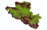
thumbnail
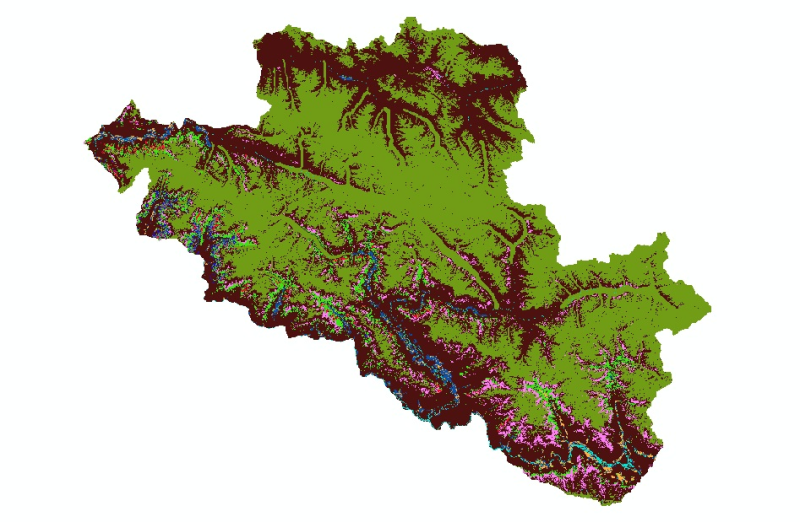
large_thumbnail
Spatial extent

Provided by

Associated resources
Not available