 Metadata Catalogue
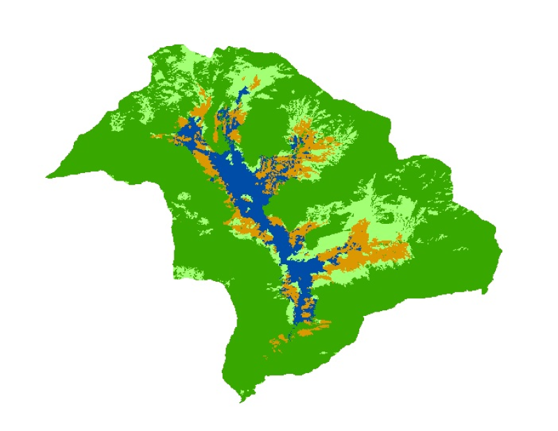
Land Cover in Phobjikha Valley, Bhutan
Digital dataset of Land Cover of Phobjikha, Bhutan. This dataset is derived from 2.5m SPOT5 satellite image.
Simple
- Date ( Publication )
- 2012-01-09T12:10:00
- Edition
- First
- Identifier
- np
- Presentation form
- Digital image
- Other citation details
- ICIMOD. (2012). Land Cover in Phobjikha Valley, Bhutan [Data set]. ICIMOD. https://doi.org/10.26066/RDS.8900
- Purpose
- Topographic base data for any purpose
- Credit
- This dataset has been developed by SERVIR Himalaya. SERVIR is a joint USAID-NASA project. For more information on SERVIR, visit http://www.servirglobal.net.
- Status
- Completed
Originator
ICIMOD
-
(
)
977 1 5003299
ICIMOD
,
Kathmandu
,
Khumaltar lalitpur
,
GPO Box 3226
,
Nepal
977 1 5275222
977 1 5003299
- Maintenance and update frequency
- As needed
- Keywords ( Theme )
-
- Landcover
- Land use
- servircat
- icimod-servir
- Keywords ( Place )
-
- Phobjikha
- Bhutan
Resource constraints
- Use limitation
- geossDataCore
- Use limitation
- Creative Commons Attribution 4.0 International (CC BY 4.0)
- Use limitation
- Users are permitted to copy, use, adapt, and redistribute SERVIR data without limitations. SERVIR encourages users to keep any adapted or redistributed versions of this data freely available for public use.
- Access constraints
- License
- Use constraints
- License
- Metadata language
- eng
- Character set
- UTF8
- Topic category
-
- Geoscientific information
N
S
E
W
))
- Reference system identifier
- WGS 1984 UTM Zone 45N
- Hierarchy level
- Dataset
- File identifier
- 4263e60f-e015-4f93-a720-4f75110a5510 XML
- Metadata language
- eng
- Character set
- UTF8
- Date stamp
- 2026-02-02T23:28:09
- Metadata standard name
- ISO 19115:2003/19139
- Metadata standard version
- 1.0
Author
ICIMOD, SERVIR Himalaya
-
(
Senior Cartographer/GIS Analyst
)
977 1 5003299
ICIMOD
,
Kathmandu
,
Khumaltar lalitpur
,
GPO Box 3226
,
Nepal
977 1 5275222
977 1 5003299
Overviews

thumbnail
large_thumbnail
Spatial extent
N
S
E
W
Provided by

Associated resources
Not available