 Metadata Catalogue
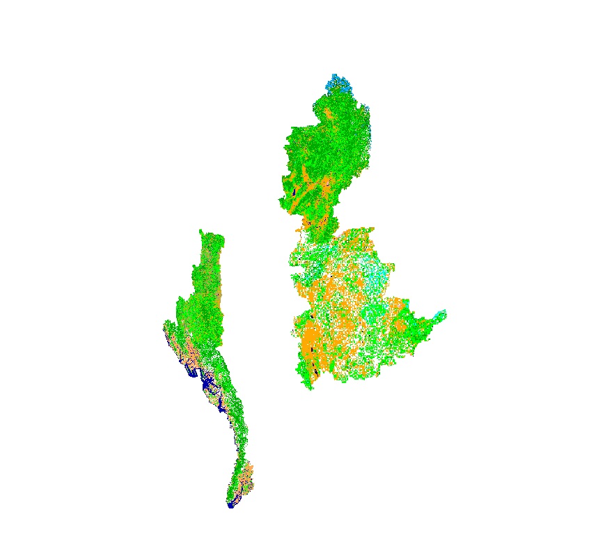
Land Cover of Myanmar 2010
Land cover data of Hindu Kush Himalayan region of Myanmar for 2010. This dataset is created using the LandSat 30 meter spatial resolution satellite image of 2010 and includes land cover information for Chin, Kachin, Rakhine and Shan states of Myanmar.
Simple
- Date ( Publication )
- 2011-12-27T11:31:00
- Edition
- First
- Identifier
- en
- Other citation details
- ICIMOD. (2018). Land Cover of Myanmar 2010 [Data set]. ICIMOD. https://doi.org/10.26066/rds.28633
- Purpose
- Development of baseline information for environmental management.
- Credit
- This dataset has been developed by SERVIR Himalaya. SERVIR is a joint USAID-NASA project. For more information on SERVIR, visit http://www.servirglobal.net.
- Status
- Completed
- Maintenance and update frequency
- As needed
- Keywords ( Theme )
-
- Land Cover Classification
- Land cover
- servircat
- icimod-servir
- Keywords ( Place )
-
- Myanmar
Resource constraints
- Use limitation
- geossDataCore
- Use limitation
- Creative Commons Attribution 4.0 International (CC BY 4.0)
- Use limitation
- Users are permitted to copy, use, adapt, and redistribute SERVIR data without limitations. SERVIR encourages users to keep any adapted or redistributed versions of this data freely available for public use.
- Access constraints
- License
- Use constraints
- License
- Denominator
- 50000
- Metadata language
- eng
- Character set
- UTF8
- Topic category
-
- Geoscientific information
N
S
E
W
))
- Reference system identifier
- WGS 1984
- OnLine resource
- Land Cover Dynamics in Myanmar ( WWW:LINK-1.0-http--link )
- OnLine resource
-
Data Download
(
WWW:LINK-1.0-http--related
)
Data Download
- Hierarchy level
- Dataset
- File identifier
- 3efb4b5f-6925-4e88-8cd8-373ed895a8fd XML
- Metadata language
- eng
- Character set
- UTF8
- Date stamp
- 2026-01-21T12:06:23
- Metadata standard name
- ISO 19115:2003/19139
- Metadata standard version
- 1.0
Point of contact
ICIMOD
-
Sameer Bajracharya
(
Research Associate GIS
)
977 1 5003299
ICIMOD
,
Lalitpur
,
Khumaltar
,
GPO Box 3226, Kathmandu
,
Nepal
977-1-5275222
977 1 5003299
Overviews

thumbnail
large_thumbnail
Spatial extent
N
S
E
W
Provided by

Associated resources
Not available