Metadata Catalogue
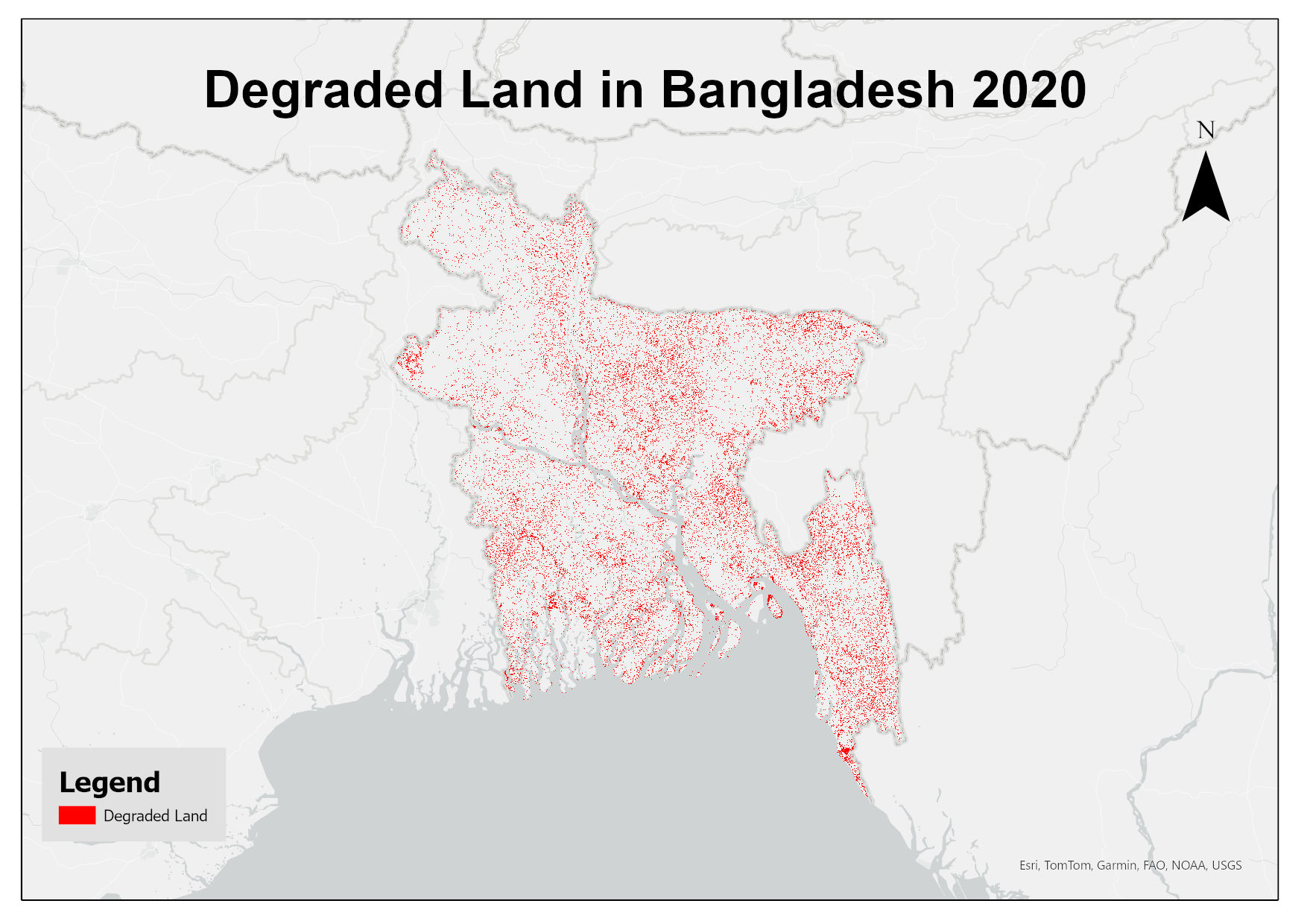
Degraded Land in Bangladesh 2020
This dataset assesses land degradation in Bangladesh in 2020 based on SDG Indicator 15.3.1 by analyzing changes in land cover, land productivity, and soil organic carbon stocks. The 1OAO principle is applied in the computation method where changes in the sub-indicators are classified as improving, declining and stable. A land unit is considered degraded if any sub-indicator shows a negative or remains stable when previously degraded.
Simple
- Date ( Publication )
- 2025-09-25
- Other citation details
- ICIMOD. (2025). Degraded Land in Bangladesh 2020 [Data set]. ICIMOD. https://doi.org/10.26066/RDS.1973251
- Purpose
- This dataset has been prepared for monitoring the land degradation in Bangladesh under ICIMOD-CBAS Partnership Project on SDG-15.
- Status
- Completed
- Maintenance and update frequency
- As needed
- ( Theme )
-
- land degradation
- degradation
- Keywords ( Place )
-
- Bangladesh
- Use limitation
- Creative Commons Attribution 4.0 International (CC BY 4.0)
- Access constraints
- License
- Use constraints
- License
- Spatial representation type
- Grid
- Distance
- 30 m
- Metadata language
- eng
- Character set
- UTF8
- Topic category
-
- Geoscientific information
N
S
E
W
))
- Reference system identifier
- WGS 1984
- Hierarchy level
- Dataset
- File identifier
- 386f3173-af8a-4742-b964-9f7ed7459447 XML
- Metadata language
- eng
- Character set
- UTF8
- Hierarchy level
- Dataset
- Date stamp
- 2026-02-02T14:40:01
- Metadata standard name
- North American Profile of ISO 19115:2003