Metadata Catalogue
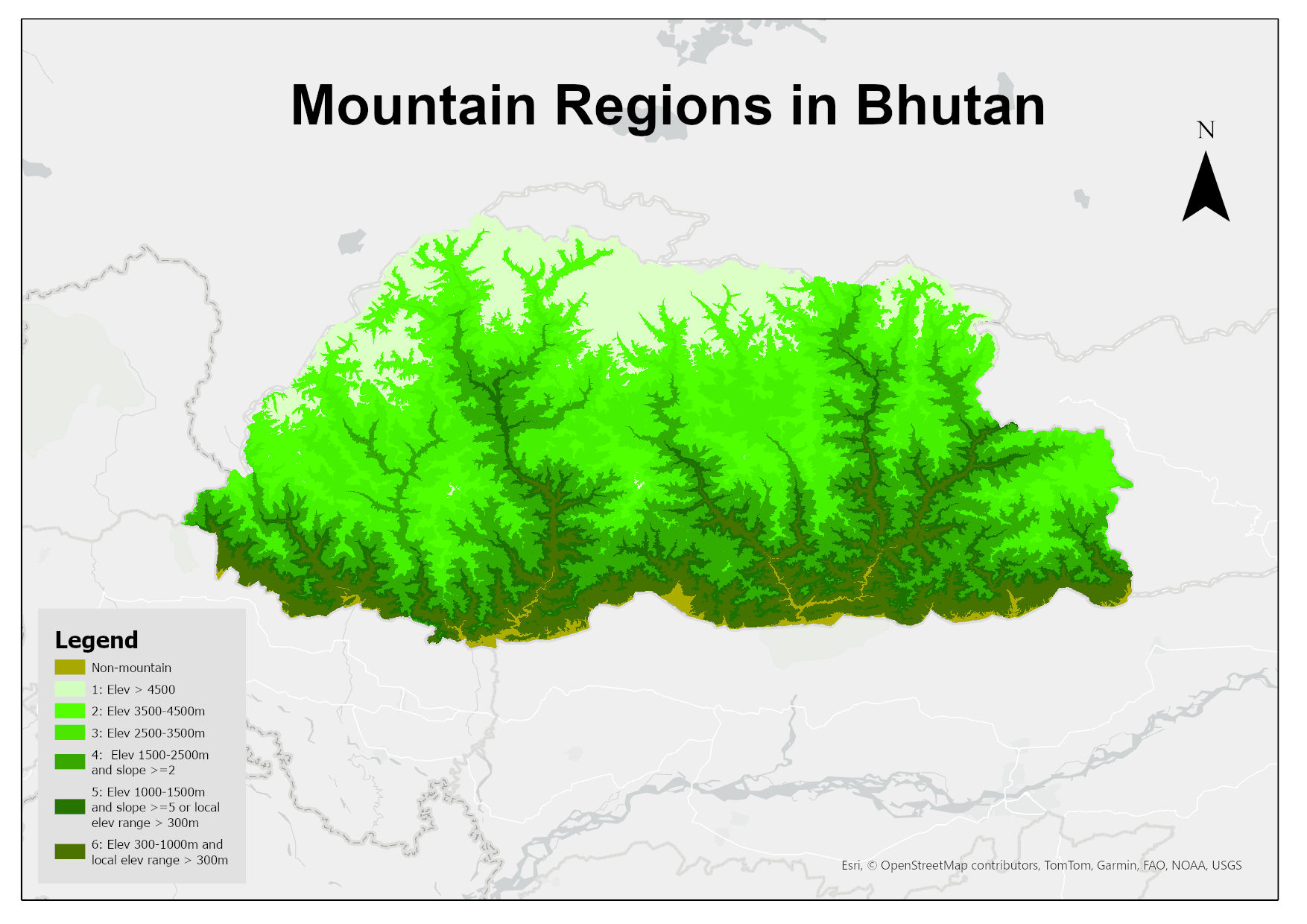
Mountain Regions in Bhutan
Digital raster dataset representing the mountain regions in Bhutan. This dataset is prepared based on SRTM 30m resolution DEM showing different classes of mountains in the country defined by the Kapos et al. (2000):
Class 1: elevation > 4500m;
Class 2: elevation 3500–4500m;
Class 3: elevation 2500-3500m;
Class 4: elevation 1500–2500m and slope >= 2deg;
Class 5: elevation 1000–1500m and slope >= 5deg or local elevation range (7km radius) > 300m;
Class 6: elevation 300–1000m and local elevation range (7km radius) > 300m;
Simple
- Date ( Publication )
- 2025-09-25
- Other citation details
- ICIMOD. (2025). Mountain Regions in Bhutan [Data set]. ICIMOD. https://doi.org/10.26066/RDS.1973237
- Purpose
- This dataset has been prepared for deriving mountain green cover index layer for Bhutan under ICIMOD-CBAS Partnership Project on SDG-15.
- Status
- Completed
- Maintenance and update frequency
- As needed
- ( Theme )
-
- mountain classification
- mountain
- Keywords ( Place )
-
- Bhutan
- Use limitation
- Creative Commons Attribution 4.0 International (CC BY 4.0)
- Access constraints
- License
- Use constraints
- License
- Spatial representation type
- Grid
- Distance
- 30 m
- Metadata language
- eng
- Character set
- UTF8
- Topic category
-
- Geoscientific information
N
S
E
W
))
- Reference system identifier
- WGS 1984
- Hierarchy level
- Dataset
- File identifier
- 27a85c69-fc9d-4ebe-b9c1-ef4a8356b778 XML
- Metadata language
- eng
- Character set
- UTF8
- Hierarchy level
- Dataset
- Date stamp
- 2026-02-02T14:39:52
- Metadata standard name
- North American Profile of ISO 19115:2003